Tag Archives: airport

309 X-Wing Drones

Disney is reportedly testing X-Wing drones for its Star Wars: Galaxy’s Edge promotion. Also, counter UAS technology tested at Dover AF Base, drones that help manage weed infestations, using a UAV to safely sample water in a volcano crater, and a large fine for landing a quadcopter at an airport.

UAV News

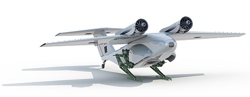
Disney Testing X-Wing Drones to Fly Over Star Wars: Galaxy’s Edge

Reportedly, Disney is testing large X-Wing drones to fly over Star Wars: Galaxy’s Edge. Blog Mickey has aerial spy photos to support the speculation, and they received a grainy photo of one of the X-Wing drones. They say Disney has been working on the secret project from a temporary tent in the cast member parking lot at Disney’s Hollywood Studios.

Dover AFB partners with Delaware CAP for counter UAS testing

A UAS is an obvious potential threat to military installations, and U.S. military forces are training and equipping to counter the threat. At a Dover Operational Readiness for a Multi-domain Agile Response Exercise this month, the 436th Airlift Wing tested its C-UAS counter unmanned aerial system capabilities. The Delaware Civil Air Patrol provided commercial drones for the test, as well as trained and certified pilots.

Drone Tech Takes Weed Control on the Farm to a New Level

This article discusses agricultural drone applications, including weed identification and mapping, the aerial application of herbicides, and UAVs for aquatic weed management.

Volcano Watch: Pondering the pond — what Halema‘uma‘u water chemistry tells us

The Hawaiian Volcano Observatory (HVO) used a multi-rotor to take a sample from a water lake in a collapsed crater. The water has been rising a meter a week since July and the water’s chemistry can tell scientists a lot about what is going on underground.

Video: Fissure 8 view from UAS provides critical geologic information

Drone pilot fined $20,000 after fly-away DJI Phantom 3 lands at McCarran Airport in Las Vegas

After a drone landed right next to an active runway at McCarran International Airport in Las Vegas, the pilot was fined $14,700 by the FAA. When the man failed to pay the fine, or appeal the fine, it increased to $20,000. The FAA had to expend some effort to identify the pilot because the drone registration number was invalid.

301 Drones for Activism

Climate activists plan to use drones for activism at Heathrow Airport. Also, how the trade war is impacting the drone community, the FAA is issuing more emergency COA’s, the RAAF is working closely with the U.S. Navy on the MQ-4C Triton, a startup is using a drone to generate electricity, an anonymous reporting portal for drone incidents is coming, and a look at the “drone bubble.”

UAV News

Climate activists plan to use drones to shut down Heathrow Airport next month

UK organization Heathrow Pause says they will fly drones for activism near Heathrow to protest the third runway proposed for the airport. Starting on September 13, 2019, they intend to fly toy drones at up to 6 feet high inside the airport 5km no-fly zone, not within flight paths, and early in the morning when no flights are scheduled. Travelers who may be impacted by this drone activism can read a statement by Heathrow Pause on their website: About the Disruption to Travellers.

Tariffs with a Capital T: How the Trade War with China is Affecting the Drone Community

Tariffs are paid to Customs when certain goods are imported. They are generally baked into the price charged to consumers, like any cost of doing business. How are Chinese drones and replacement parts affected by tariffs, and how are sellers responding?

FAA Requests for Emergency UAS Airspace Authorizations on the Rise

The number of requests and approvals for emergency COAs are up over last year. In 2018, FAA issued 708 Special Government Interest (SGI) airspace authorizations while through July 2019, more than 600 had been issued by the FAA System Operations Security Directorate to law enforcement for major events like fires and hurricanes.

U.S., Australia work side-by-side on Triton UAS development

The Royal Australian Air Force (RAAF) has been working with the U.S. Navy’s Northrop Grumman MQ-4C Triton team. The HALE UAV is designed to provide ISR over the ocean and coastal regions. The RAAF has agreed to purchase up to six Triton aircraft and associated Mission Control Stations.

Swiss start-up dreams of powering homes using drones

Swiss startup company Skypull wants to use drones to generate electricity from high-altitude winds. The wind generator that can be deployed almost anywhere. A high-lift, low drag “box wing” drone pulls a tether to a drum on the ground that converts the force into electricity.
Video: Skypull promo 2017.

Altitude Angel launches industry first “just culture” reporting system

In Episode 294 we reported that UK company Altitude Angel planned to launch a UTM conflict resolution service as an API. Now Altitude Angel says they’ll launch an anonymous web portal reporting system for drone pilots and operators, similar to that used in manned aviation.

Drone bubble bursts, wiping out startups and hammering VC firms

Teal Group says venture capitalists poured $2.6 billion into drones from the beginning of 2012 to June 2019. Now we are seeing startups fold or consolidate. Kay Wackwitz, founder and chief executive officer of research group Drone Industry Insights says, “There was some irrationality around drones, a period of hype driven by the popularity of the hobby sector. We’re getting past that and people are coming back to reality.”

UAV Video of the Week

Dronehackers was created to showcase how drones can be used to help solve real-world problems. The project seeks to inspire the next generation of builders, DIY’ers, and creators with something entertaining and educational.

The sizzle reel: Dronehackers – Episode 0 (Sizzle Reel)

The full episode: Dronehackers – Episode 0.

297 Nano Drones, Swarms, and AI

A drone crash halts Swiss package delivery, AI used to detect drone faults and locate/track other drones, swarming nano-drones, mesh networked drones for precision agriculture, a drone mesh for event security, UAS for airport and public safety, and the reliability of drone sightings from aircraft.

UAV News

Swiss drone crashes near children, forcing suspension of delivery program

In May, a 22-pound Swiss Post drone crashed 50 yards away from a group of children. As a result, the drone delivery program in Switzerland has been suspended indefinitely. Swiss Post has asked Matternet to make several changes to the system: parachutes connected to the UAV by two ropes instead of one, ropes reinforced with metal braiding, and a louder emergency landing whistle.

Fault Diagnosis of Drone Propellers Using AI

Propeller defects in drones can cause them to fall from the sky and researchers have used different methods to perform fault diagnosis. But a new study by Italian researchers takes a different approach and focuses on measuring the noise emitted by the drone. Different noise patterns are used to build an artificial intelligence (AI) model that detects unbalanced blades in a UAV propeller. See Fault Diagnosis for UAV Blades Using Artificial Neural Network.

Drones Chasing Drones Using Deep Learning and AI

A Canadian study proposes target-detection and target-following using AI techniques for UAV pursuit-evasion. Deep reinforcement learning predicts the actions to apply to the follower UAV to keep track of the target UAV. A deep object detector and a search area proposal predict the position of the target UAV for tracking purposes. The proposed framework uses vision data. See Drones Chasing Drones: Reinforcement Learning and Deep Search Area Proposal.

The amazing world of nano drones

Nano drones have been studies for several years. Draper Lab’s DragonflEye drone project was announced in 2017. A real dragonfly wears a tiny backpack fitted with electronics, sensors, and a solar cell. AeroVironment has been working on a nano-hummingbird since 2011. The market for the nano drones alone is expected to reach $13.4 billion by 2023.

If one drone isn’t enough, try a drone swarm

Drones are being used for precision agriculture, but there are shortcomings with one drone and a big farm. Many battery changes may be required and the survey could take a lot of time. The Norwegian Defence Research Establishment and Rajant Corporation in the US are working on a drone swarming approach with decentralized communications, self-organizing drones, and little human supervision. The technology uses Rajant’s “Kinetic Mesh®” radio technology and “foreign function interface” distributed computing software.

Atlas Multi-Drone System Used by Rio Military Police to Secure Soccer Tournament

Atlas Dynamics partnered with the Military Police of Rio de Janeiro State to use the AtlasPRO  at the Copa America soccer (football) tournament. The AtlasPRO was flown in single and multi-UAS missions along the perimeter of the stadium during the tournament’s final series. Data was gathered on public safety hazards and to facilitate emergency response. This was the first time the Atlas mesh multi-drone UAS technology was approved for use at a major sporting event. The mesh multi-node communication capability allows a single operator to command and control a drone network from a unified ground control system. The operator can divide missions among several UAS and maintain constant “eyes in the sky” using autonomous hot-swap capabilities.

Report: Data Management a Challenge for Public Safety UAS Programs

Droneresponders has released the 2019 Mid-Year Public Safety UAS Report. Three out of four public safety agencies say they are already either operating drones or working on implementing a drone program. More than 80% of public safety UAS operators either have obtained or are pursuing, their FAA Part 107 certification. 82% of public safety agencies with a UAS program are operating multi-rotor systems, while only 11% are using fixed- or delta-wing drones. Over 35% of public safety UAS programs are using the FAA’s LAANC system for airspace requests.

UAS Used For Part 77 Airport Inspections in Washington

AeroTEC has completed proof-of-concept aerial surveys in Washington State at Sunnyside Municipal Airport (1S5) and Prosser Airport (S40). The AeroTEC system looks for runway obstacles using photogrammetry to meet the requirement of FAA FAR 14 CFR Part 77. See AeroTEC Conducts First UAS Part 77 Survey of Washington State Airports for WSDOT.

Video of the Week

Epic Long Range FPV Mountain Surfing – 7km round trip

Mentioned

Drone Sightings (2014-2018) from the FAA from Rupprecht Law.

294 DJI Government Edition

DJI announces it’s “Government Edition” hardware and software to address data security fears, while one company drops Chinese drones from its services. A public safety alliance announces its board of advisors, an unmanned surface vehicle rescues swimmers, an interim report on UAS mitigation at airports is published, a drone operations app is launched in Australia, and a de-confliction service for drone flights is available via an API.

UAV News

Interior Department Approves Government Edition DJI Models

Amid all the government concerns and restrictions concerning Chinese drones, DJI has come up with a solution: the DJI Government Edition hardware and software. This is intended exclusively for government agencies and DJI says the Government Edition offers advanced security measures, ensuring governments can perform their essential drone work confidently and securely. The drone does not require activation with DJI, drones and controllers will not pair with off the shelf components, and local data mode is permanently enabled.

Video: DJI – Introducing DJI Government Edition

Technology Supplier to U.S. Police Agencies Bans Chinese Drones

California-based startup Cape says it’s going to tell its customers that it will no longer sell software that is compatible with Chinese drones. The Cape Aerial Telepresence™ software platform allows clients to quickly and remotely dispatch and operate drones to surveil incidents or crime scenes. An on-site iPad with internet connectivity is connected to the drone’s remote control transmitter. The pilot live-streams video to any iOS or Android platform and during remote operations, the teleoperator can use a computer to control the drone from anywhere.

DRONERESPONDERS Public Safety Alliance Announces Inaugural Board of Advisors

DRONERESPONDERS is a non-profit program that was formed to bring together aerial first responders, emergency managers, and search and rescue specialists. They want to foster drone operations for public safety by learning, training, and testing one another. The DRONERESPONDERS Public Safety Alliance is operated as an official program under AIRT Inc., the Airborne International Response Team, a 501(c)3 non-profit organization formed in 2017 to help provide unmanned aviation research and charitable contributions for public safety and disaster relief.

EMILY USV saves four swimmers at Oregon beach

The Emergency Integrated Lifesaving Lanyard (EMILY) USV was recently used to rescue four swimmers from the ocean at Rockaway Beach in Oregon. The unmanned surface vehicle was deployed by the Rockaway Fire Department deployed EMILY to save two young boys and their family members that tried to rescue them.

Blue Ribbon Task Force Releases Interim Report on UAS Mitigation at Airports

The Blue Ribbon Task Force on UAS Mitigation at Airports was commissioned in 2019 by AUVSI and ACI-NA to address the issue of incursions by unauthorized UAS at US airports and how best to mitigate the threat. The Task Force released its Interim Report on July 12, 2019, with over twenty recommendations to industry and government on steps that should be taken to safeguard airports from UAS incursions. The Task Force will also solicit comments on its website from interested parties.

Introducing OpenSky — a platform to empower everyone to safely access the sky

Alphabet’s Wing has formally introduced its OpenSky app for iOS and Android devices in Australia. Wing says OpenSky is “a family of software products that will give drone operators a greater understanding of, and access to, the sky around them. OpenSky products will help users comply with rules and plan flights more safely and effectively.” After entering a location, the Australian OpenSky app gives you a checklist of critical factors such as airspace restrictions, known hazardous situations, and proximity to airports and heliports. Users also get alerts that relate to emergency response situations, nearby sporting events, or other situations that may impact available airspace.

Altitude Angel Launches World First UTM Conflict Resolution Service

Altitude Angel is a U.K. aviation technology company with a purpose-built cloud platform that supports both U-Space and UTM. The company is launching a de-confliction service for drone flights that is available via its developer API platform. Altitude Angel says the Conflict Resolution Service addresses some of the key risks which prevent BVLOS operations today.

273 Drone Sightings at the Airport, or Maybe Not

Flights at another major airport were halted due to drone reports, but some experts question the accuracy of the reports. Also, Boeing and Airbus advance their urban air mobility projects, multispectral camera-equipped drones and crop health, a drone that launches and lands like a bird, Facebook and it’s drone project, U-Space for harmonized UTM, and a bladeless drone.

UAV News

Newark Airport Traffic Is Briefly Halted After Drone Is Spotted

Newark drones: Flights suspended at major US travel hub after multiple sightings of unmanned aircraft

Did a pair of drones interfere with flights at Newark Airport, or was it something else?

Flights at Newark Liberty International Airport were suspended for a time due to drone activity in the area. One pilot told air traffic controllers that a drone passed within 30 feet of his plane. Were the sightings really drones? Some experts are dubious.

DJI Urges Caution In Evaluating Reports Of Drone Incidents

DJI says they are “monitoring recent reports of drones flying in close proximity to various airports, and has offered assistance to investigators and airports where these sightings have occurred. To date, none of these reports have been confirmed, and there is no proof that any of these alleged incidents occurred. Despite the lack of evidence, new sightings have been reported at more airports, raising the prospect that new reports are being spurred by publicity from past incidents.”

UAV-based Remote Sensing Can Help Avocado Growers by Detecting Asymptomatic Pathogen

University of Florida scientists published research that says multispectral cameras can detect laurel wilt on avocado trees. An otherwise “time-consuming, labor-intensive and costly” traditional process could be replaced with an unmanned aerial vehicle.

Delivery Drones Use Bird-Inspired Legs to Jump Into the Air

Passerine Aircraft Corporation has a fixed-wing drone that can take off (and land) using a pair of legs. It’s VTOL without the rotors. The drone also utilizes a “blown wing’ to generate more lift than would otherwise be the case.

The Passerine Aircraft Corporation Sparrow
A computer rendering of Sparrow. Courtesy Passerine Aircraft Corporation .

Videos: Sparrow Jumper — March 2018 Showcase and Early onboard flight footage from the Sparrow test flights.

Facebook hasn’t given up on the idea of building an internet drone

According to the German publication, NetzPolitik in Facebook and Airbus hold secretive drone tests in the Australian bush, Facebook is proceeding with a drone program in conjunction with Airbus. NetzPolitik published a document [PDF] they say supports the claim. The document is dated March 14, 2018, and was obtained from the Australian Civil Aviation Safety Authority (CASA) under the Australian Freedom of Information Act.

Concept of Operations for safe European drone traffic: registration for workshop now open

CORUS (Concept of Operations European UTM Systems) has a concept for a European system for drone management called U-Space. Aviation stakeholders are being brought together to develop a concept of operations for U-Space in a workshop 2-5 April 2019 in Italy. Click for more information.

Boeing Autonomous Passenger Air Vehicle Completes First Flight

The first flight of the Boeing NeXT passenger air vehicle (PAV) prototype has taken place. Boeing subsidiary Aurora Flight Sciences designed and developed the electric vertical takeoff and landing (eVTOL) aircraft. Boeing NeXt leads the company’s urban air mobility efforts for on-demand autonomous air transportation.

Boeing NeXT passenger air vehicle prototype.
Boeing NeXT passenger air vehicle prototype. Courtesy Boeing.

Besides the PAV, the Boeing NeXt portfolio includes an unmanned fully electric cargo air vehicle (CAV) designed to transport up to 500 pounds (226.80 kilograms) and other urban, regional and global mobility platforms.

Airbus’s Flying Taxi Is Poised for Takeoff Within Weeks

The prototype flying taxi is called CityAirbus. The four-seat model for urban environments is undergoing tests at the Airbus helicopter plant in Germany. Initial flights are planned to be unmanned, with an entry into service for the autonomous vehicle planned as early as 2023.

Video of the Week

Bladeless Drone: First Flight

271 Fuel Cell Drone

A fuel cell drone flies for over an hour, new drone laws for Canada and the UK, another airport incursion, terrorists and UAVs, the world’s smallest and lightest weather station, and using drones to insert sensors in the soil.

UAV News

First ever hour-long flight for hydrogen multi-rotor UAV with 5kg payload

Project RACHEL is an attempt to develop a hydrogen fuel cell powered multi-rotor UAV with a flight target of 60 minutes carrying a 5kg payload. Project RACHEL is supported by Innovate UK, and led by venture engineering company Productiv on behalf of UK UAV filming specialists BATCAM. The fuel cells come from Intelligent Energy which is commissioning specialist hydrogen fuel systems supplier NanoSUN to develop a portable refueling solution.

Further information about the project and video of the flight test can be found at The Hydrogen Drone.

Transport secretary to introduce new drone laws within months

Secretary of state for transport, Chris Grayling MP, has told the House of Commons that new drone laws will be introduced in the coming months, likely May 2019. The new rules increase airport exclusion zones to 5km (now 1km), and give police the right to interfere with the movement of drones and inspect devices to ensure safety features had not been tampered with. In November, owners of drones weighing between 250g and 20kg must register and take an online drone pilot competency test.

Heathrow airport: Drone sighting halts departures

A drone was reportedly sighted at Heathrow Airport. As a “precautionary measure,” flights were halted for about an hour. A BBC cameraman was driving on the M25 past Heathrow airport when he saw what he believes was a drone.

ISIS ‘has capability to launch DRONE bomb attacks in UK’

The MI5 intelligence agency fears drone attacks against civilian and military targets. Reportedly, they have documents showing terrorist plans. MI5 believes they are from ISIS, and worries that up to a dozen weaponized drones could be used.

Minister Garneau unveils Canada’s new drone safety regulations

Transport Canada has new rules for remotely piloted aircraft systems that apply to drones between 250 grams and 25 kg, operated within the drone pilot’s visual-line-of-sight, and flown for recreation, commercially, or for research. The rules include drone registration, an exam and pilots certificate, a minimum age, flight below 122 m (400 feet) AGL, and a requirement to stay away from air traffic. Flying outside the rules requires a Special Flight Operations Certificate (SFOC). For more information, see the government Drone Safety website.

TriSonica Mini Wind and Weather Sensor Suited for Use on Drones

Specialized meteorological instrument design firm Anemoment LLC has announced the availability of the TriSonica Mini Wind and Weather Sensor that cen be integrated with drones.

They call the 50 gram device “the world’s smallest and lightest 3D ultrasonic anemometer.” It can measure wind speed, direction and temperature, magnetic heading, relative humidity, air pressure, and dew point wind.

How to Dig a Hole With Two Drones and a Parachute

The NIMBUS Lab at the University of Nebraska has developed a two-drone system that can fly to a designated location, land, drill a hole and deploy a sensor, then fly away. The UAS can deploy sensors in locations that are otherwise difficult to reach. The sensor is inserted into the soil using an auger attached to the drone. The UAS identifies the proper target location, breaks the ground surface, removes the soil, and places the sensor.

Video: Unmanned Aerial Auger for Underground Sensor Installation

Video: Parachute and Digging UAS

269 Rogue Drone at the Airport

A rogue drone repeatedly violated Gatwick Airport airspace with massive consequences. Separately, a drone is suspected of colliding with an airliner. Also, ANSI releases a standardization roadmap, and drones are being used to study peatlands in Australia, deliver items over a mobile network, locate nests of protected birds, and support Mars rover tests.

UAV News

Rogue drone pilot taunts police: Army join snipers in cat and mouse game as Gatwick drone is spotted over runway AGAIN just minutes before it was due to re-open – with chaos set to last until Christmas Eve

Gatwick Airport was thrown into chaos as the airport was shut down after a rogue drone repeatedly entered the airspace. Some 760 flights were grounded and 110,000 people were stranded. A drone buzzed the airport many times and the authorities were hard-pressed to remove the threat.

ANSI Standardization Roadmap for Unmanned Aircraft Systems Published

The American National Standards Institute (ANSI) announced the publication of the Standardization Roadmap for Unmanned Aircraft Systems (Version 1.0). The roadmap was developed by the Institute’s Unmanned Aircraft Systems Standardization Collaborative (UASSC) “to coordinate and accelerate the development of the standards and conformity assessment programs needed to facilitate the safe integration of unmanned aircraft systems into the national airspace system of the United States.” The roadmap examines 64 issue areas and identified 60 gaps with no published standard or specification.

Using Drones to Monitor Peatlands

Researchers in Australia are interested in monitoring peatlands and they are using ultra-high spatial resolution imagery from drones. The researchers want to test the viability of creating hydrological models that monitor hydrological changes and assist in the rehabilitation of damaged peatlands.

Vodafone Conducts UK’s First Drone Delivery Over a Mobile Network

Vodafone has made a drone delivery over a 4G mobile network. The Christmas drone made a short 800-meter flight and delivered festive treats.

Video: Vodafone brings Christmas cheer with UK’s first drone delivery over a mobile network

Boeing 737 damaged in possible drone crash near U.S.-Mexico border

Aeromexico Flight 773, a Boeing 737, was struck in the nose on final approach to Tijuana International. The damage was substantial and the incident is under investigation.

Drones can detect protected nightjar nests

Cardiff University ecologists conducted a pilot study in South Wales using drones with thermal imaging sensors to locate ground-dwelling nightjars without disturbing the birds.

Self-driving rovers tested in Mars-like Morocco

Three autonomous SherpaTT rovers were tested for over two weeks in an environment close to that of Mars. Prior to the tests, ESA used a drone to map the location and create high-resolution digital elevation models.

Is someone getting a drone for Christmas? Raleigh will help you find a place to fly it.

The City Council of Raleigh, North Carolina approved a policy for where and when people can fly drones in the city’s parks. The city parks department then created a website with the rules and a map showing where you can take off and land: Unmanned Aerial Systems (Drones) Guidelines in Raleigh Parks.