Tag Archives: Dragonfly

303 Ehang Autonomous Aerial Vehicle

EHang is flying its urban air mobility vehicle contender. Remote identification of drones is moving forward. Also, using drones to measure methane emissions, find standing water where mosquitoes breed, assess hurricane damage, explore Titan, and plant trees.

UAV News

EHang completes first passenger-carrying autonomous aerial vehicle demonstration flight

The EHang 216 passenger-carrying autonomous aerial vehicle (or AAV) was flown at the 2019 Northeast Asia Expo in August. Ehang has been demonstrating the aircraft at several cities in China as well as in Austria, the Netherlands, and Qatar. Ehang says, “This is a critical step towards making our dream [a] reality and to make urban air mobility broadly available and affordable as a safe, fast, and eco-friendly transportation alternative.”

Video: EHang AAV Trial Flights Across Cities in China

Electronic License Plates for Drones May Come Soon

A draft of the proposed ASTM standard for electronic identification of drones is available as ASTM WK65041, “New Specification for UAS Remote ID and Tracking.” During operation, a drone would transmit a unique ID, location, and vector. The chairman of ASTM International’s Committee F38 on Unmanned Aircraft Systems said, “You can just take a phone, point it up at a drone and get its electronic ID if you see it doing something dangerous. [And you can report it] just like reporting a car’s license plate number.” Old drones can be retrofitted with ID chips that would plug into their USB ports and might cost $7 to $12.

BP deploys continuous methane measurement for new major oil and gas projects

BP said it is going to monitor its methane emissions around the world using a technology called gas cloud imaging and drones. Inspections would take 30 minutes instead of seven days. The sensor technology was originally designed by NASA for the Mars Curiosity Rover. This is a key part of BP’s strategy to deploy a suite of complementary methane detecting techniques across new and existing facilities.

Anthropology professor deploys drone to fight disease in Africa

Mosquitoes are the main transmitters of malaria, and they breed in standing water. Agricultural irrigation can create standing water which is difficult to detect with satellite imagery. In the East African nation of Malawi, Professor Jon Carroll and other researchers from Oakland University spent nine days collecting data on the effectiveness of drone imagery to detect standing water.

AIRT uses UAS to perform damage assessment operations in the Bahamas following Hurricane Dorian

Two organizations have formed a joint-reconnaissance team to survey the Bahamas following Hurricane Dorian: the Airborne International Response Team (AIRT) and the Southeast Florida Region 7 All-Hazards Incident Management Team (SEFL-R7 AHIMT). Disaster scenes were mapped by UAS with high-resolution camera systems.

Meet The Nuclear-Powered Self-Driving Drone NASA Is Sending To A Moon Of Saturn

The Dragonfly is a dual-rotor quadcopter, about the size of a compact car, autonomous, and nuclear powered. Expected to launch from Earth in 2026 and arrive on Titan in 2034, Dragonfly will explore Titan’s dunes, mountains, gullies, and rivers and lakes of liquid methane.

NASA Video: New Dragonfly Mission Flying Landing Sequence Animation.

Middle East drones signal end to era of fast jet air supremacy

Air superiority has been key to winning wars since airplanes were invented. But compared to the world’s major air forces, drones are small, low cost, and they don’t put a pilot into the war-zone.

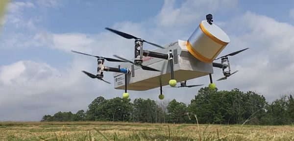
This startup lets you subscribe to support an army of drones that’s planting millions of trees

A new startup called Now wants to “mobilize humanity to reverse the climate crisis.” The organization was created by 19-year-old activist and musical artist Xiuhtezcatl Martinez who says that if a trillion trees are planted, they could capture two-thirds of the carbon that humans have emitted since the industrial revolution. The subscription concept of Now would fund planting trees with drones. See also 19-Year-Old Xiuhtezcatl Martinez Isn’t Waiting For Permission to Solve the Climate Crisis: “The Time Is NOW.”

Conference

Commercial UAV Expo Americas 2019, October 28-30, 2019 in Las Vegas. Video: Commercial UAV Expo 2018 in a minute.

297 Nano Drones, Swarms, and AI

A drone crash halts Swiss package delivery, AI used to detect drone faults and locate/track other drones, swarming nano-drones, mesh networked drones for precision agriculture, a drone mesh for event security, UAS for airport and public safety, and the reliability of drone sightings from aircraft.

UAV News

Swiss drone crashes near children, forcing suspension of delivery program

In May, a 22-pound Swiss Post drone crashed 50 yards away from a group of children. As a result, the drone delivery program in Switzerland has been suspended indefinitely. Swiss Post has asked Matternet to make several changes to the system: parachutes connected to the UAV by two ropes instead of one, ropes reinforced with metal braiding, and a louder emergency landing whistle.

Fault Diagnosis of Drone Propellers Using AI

Propeller defects in drones can cause them to fall from the sky and researchers have used different methods to perform fault diagnosis. But a new study by Italian researchers takes a different approach and focuses on measuring the noise emitted by the drone. Different noise patterns are used to build an artificial intelligence (AI) model that detects unbalanced blades in a UAV propeller. See Fault Diagnosis for UAV Blades Using Artificial Neural Network.

Drones Chasing Drones Using Deep Learning and AI

A Canadian study proposes target-detection and target-following using AI techniques for UAV pursuit-evasion. Deep reinforcement learning predicts the actions to apply to the follower UAV to keep track of the target UAV. A deep object detector and a search area proposal predict the position of the target UAV for tracking purposes. The proposed framework uses vision data. See Drones Chasing Drones: Reinforcement Learning and Deep Search Area Proposal.

The amazing world of nano drones

Nano drones have been studies for several years. Draper Lab’s DragonflEye drone project was announced in 2017. A real dragonfly wears a tiny backpack fitted with electronics, sensors, and a solar cell. AeroVironment has been working on a nano-hummingbird since 2011. The market for the nano drones alone is expected to reach $13.4 billion by 2023.

If one drone isn’t enough, try a drone swarm

Drones are being used for precision agriculture, but there are shortcomings with one drone and a big farm. Many battery changes may be required and the survey could take a lot of time. The Norwegian Defence Research Establishment and Rajant Corporation in the US are working on a drone swarming approach with decentralized communications, self-organizing drones, and little human supervision. The technology uses Rajant’s “Kinetic Mesh®” radio technology and “foreign function interface” distributed computing software.

Atlas Multi-Drone System Used by Rio Military Police to Secure Soccer Tournament

Atlas Dynamics partnered with the Military Police of Rio de Janeiro State to use the AtlasPRO  at the Copa America soccer (football) tournament. The AtlasPRO was flown in single and multi-UAS missions along the perimeter of the stadium during the tournament’s final series. Data was gathered on public safety hazards and to facilitate emergency response. This was the first time the Atlas mesh multi-drone UAS technology was approved for use at a major sporting event. The mesh multi-node communication capability allows a single operator to command and control a drone network from a unified ground control system. The operator can divide missions among several UAS and maintain constant “eyes in the sky” using autonomous hot-swap capabilities.

Report: Data Management a Challenge for Public Safety UAS Programs

Droneresponders has released the 2019 Mid-Year Public Safety UAS Report. Three out of four public safety agencies say they are already either operating drones or working on implementing a drone program. More than 80% of public safety UAS operators either have obtained or are pursuing, their FAA Part 107 certification. 82% of public safety agencies with a UAS program are operating multi-rotor systems, while only 11% are using fixed- or delta-wing drones. Over 35% of public safety UAS programs are using the FAA’s LAANC system for airspace requests.

UAS Used For Part 77 Airport Inspections in Washington

AeroTEC has completed proof-of-concept aerial surveys in Washington State at Sunnyside Municipal Airport (1S5) and Prosser Airport (S40). The AeroTEC system looks for runway obstacles using photogrammetry to meet the requirement of FAA FAR 14 CFR Part 77. See AeroTEC Conducts First UAS Part 77 Survey of Washington State Airports for WSDOT.

Video of the Week

Epic Long Range FPV Mountain Surfing – 7km round trip

Mentioned

Drone Sightings (2014-2018) from the FAA from Rupprecht Law.

UAV224 UAS Identification and Tracking

An Aviation Rulemaking Committee has released their recommendations for identification and tracking of unmanned aircraft, Airbus looks to incorporate some Formula 1 technology into their Zephyr High Altitude Pseudo-Satellite, a proposal is submitted to send a multirotor drone to one of Saturn’s moons, a drone quickly finds a missing man, and the FAA prohibits drone flights over certain facilities.

Half-scale Dragonfly test-bed vehicle

An autonomous half-scale Dragonfly test-bed vehicle built by the Penn State University Center of Excellence for Vertical Lift.

UAV News

FAA Releases UAS Remote Tracking & ID ARC Report

The Unmanned Aircraft Systems Identification and Tracking Aviation Rulemaking Committee (ARC) submitted its 213 page final report and recommendations: UAS Identification and Tracking (UAS ID) Aviation Rulemaking Committee (ARC), ARC Recommendations, Final Report. [PDF]

The FAA says, “Overall, the ARC provided the FAA with a substantial amount of useful data, including very detailed technology evaluations and a comprehensive list of law enforcement needs and preferences. The ARC’s recommendations and suggestions… cover issues related to existing and emerging technologies, law enforcement and security, and implementation of remote identification and tracking. Although some recommendations were not unanimous, the group reached general agreement on most.”

FAA Releases UAS Remote ID, Tracking Report; Groups Dissent

The ARC recommended that model aircraft operating under Section 336 of the FAA Modernization and Reform Act of 2012 be exempt from identification and tracking requirements. The dissenting opinion was that this recommendation would undermine the value of an ID and tracking requirement.

The dissenting opinion was led by the Commercial Drone Alliance and signed by the General Aviation Manufacturers Association, the Aerospace Industries Association, the National Agricultural Aviation Association, X, GE, uAvionix, Ford Motor Co., AirMap, and General Atomics. They “appreciate the extensive efforts of the ARC but strongly disagree on the critical point of who and what UAS should have to comply with ID and tracking requirements.”

The FAA will use the data and recommendations in the ARC report and produce a proposed rule for public comment.

Airbus seeks help from Formula One team to develop high altitude drone

The solar-powered Airbus Zephyr UAS is designed to fly at 65,000 feet, above weather and commercial air traffic. Acting as a “High Altitude Pseudo-Satellite (HAPS),” it is designed to fly without fuel for months in communications and surveillance roles. Airbus Unmanned Aerial Systems will work with the Williams Motorsports Formula 1 team on battery and lightweight composite materials technology.

Finalists in NASA’s Spacecraft Sweepstakes: A Drone on Titan, and a Comet-Chaser

NASA solicited proposals under the New Frontiers competition for missions to explore the solar system, and they announced two finalists.

The Comet Astrobiology Exploration Sample Return (Caesar) spacecraft would travel to the comet that was previously visited by the European Space Agency’s Rosetta mission, and return a sample for study.

The John’s Hopkins University Applied Physics Laboratory (APL) Dragonfly is a Plutonium-powered quadcopter that would be sent to Saturn’s moon Titan. It would take measurements on the surface of Titan, then fly to another location on the moon. Johns Hopkins University Applied Physics Laboratory (APL) is the principal investigator for Dragonfly.

Video: Dragonfly: A Proposal to Explore Titan, Saturn’s Largest Moon, via Quadcopter

After humans fail, drone tracks down lost 92-year-old in 20 minutes

92-year-old Bill McDonnell went hunting in Shenandoah County, Virginia but didn’t come home. Rescuers used helicopters and foot patrols but couldn’t find him. The next morning, the Loudoun County Sheriff’s Office team put up their new drone and found McDonnell in 20 minutes. Additionally, though not part of this operation, the drone is one of six in the nation that flies in the Project Lifesaver program designed to locate people with medical conditions such as Alzheimer’s who are wearing a specific wristband.

FAA Expands Restrictions to Include UAV Flights over Department of Energy Facilities

Effective December 29, 2017, drone flights below 400 feet are banned over seven DOE facilities in the interest of national security. Violations can result in tens of thousands of dollars in fines and possible criminal charges with up to one year in jail. The restrictions apply to both hobbyist drones and civil aircraft at these locations:

Idaho National Laboratory, Idaho Falls, ID
Pantex Site, Panhandle, TX
Los Alamos National Laboratory, Los Alamos, NM
Oak Ridge National Laboratory, Oak Ridge, TN
Savannah River National Laboratory, Aiken, SC
Y-12 National Security Site, Oak Ridge, TN

UAV Video of the Week

Santa & the X-MAS drones