Tag Archives: PrecisionHawk

310 Hexa Electric VTOL

Rides available in the Hexa Electric VTOL, mapping a railway project, low-altitude hurricane hunting, another reported drone strike, a DHS warning for private industry, another round of financing for PrecisionHawk, and spying on hippos with drones.

The Hexa electric VTOL passenger drone. Courtesy Lift Aircraft.

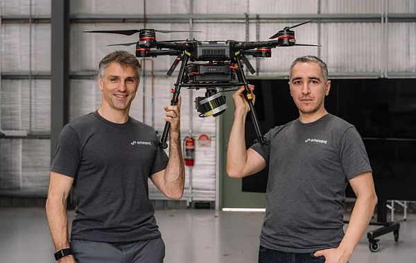
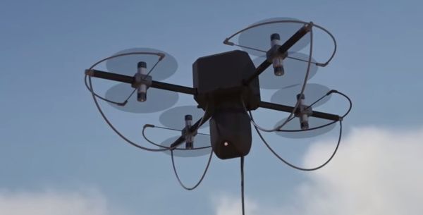
Lift Aircraft says 13,000 people have signed up for drone rides; flights begin in beta mode in Texas

In 2020, Lift Aircraft plans a 25-city tour of it’s Hexa electric VTOL passenger drone. You can register for a flight on Lift’s website. It will cost $149-$249 depending on flight duration. The 432-pound electric VTOL uses 18 independent electric motors and propellers and is controlled through a triply redundant autopilot computer and a single 3-axis joystick. Or you can tap on the seven-inch touchscreen for a “Look mom, no hands!” mode.

Flying the Hexa electric VTOL passenger drone.

What if? Norfolk Southern develops effective UAV program, but it did not come without some trial and error

Norfolk Southern Railway asked themselves if they could use lower-cost UAVs to image project areas and stitch them into survey-grade 3D mosaics for the project team. They formed a UAV field team, got a Part 107 license, and designated a 5-mile linear project. What they learned will help them (and others) in future projects.

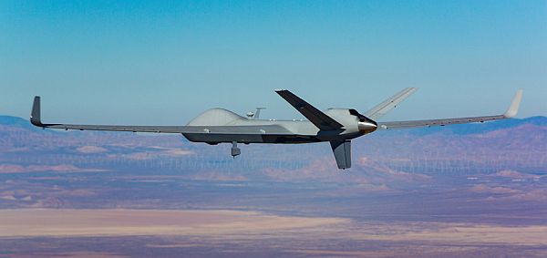
Drones Provide a New Frontier in Hurricane Observations

Hurricane hunters fly through hurricanes, but not at sea level where the winds are strongest. Scientists flew expendable Raytheon Coyote drones as low as 360 feet into several hurricanes and measured atmospheric conditions in winds as high as 194 miles per hour. These were deployed NOAA’s P-3 reconnaissance aircraft. The Coyote UAS is adaptable for a variety of missions including surveillance, electronic warfare and strike. A swarm of Coyote drones has successfully flown and demonstrated autonomous networking. A paper was recently published in the Bulletin of the American Meteorological Society: “Eye of the Storm: Observing Hurricanes with a Small Unmanned Aircraft System.”

AIR7 HD struck by suspected drone over downtown LA, makes precautionary landing

Los Angeles ABC affiliate KABC reports that their helicopter was struck midair by an object. At first, the pilot and reporter thought it was a bird strike but after landing and inspecting the damage to the helicopter tail, they believe it was a drone strike. The incident occurred at 7:15 pm, flying at 1100 feet.

DHS Continues to Warn Private Industry Against Using Foreign-Made Drones

In late November, the FBI’s Cyber and Infrastructure Security Agency issued a bulletin to private industry warning about the risk of exposing private data when using UAS manufactured abroad. The bulletin warns of possible data compromise when operating UAS “designed, manufactured, or supplied abroad where the data is stored, transferred to, or accessible by servers in a foreign country.”

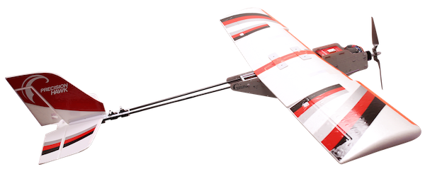
PrecisionHawk Raises $32 Million to Advance Next Phase of Growth in Commercial Drones

PrecisionHawk announced $32 million in funding by a group of venture investors. The company says this will allow them to innovate with their PrecisionAnalytics A.I.-powered aerial data analytics platform, accelerate sales initiatives, and support further market expansion. In total, PrecisionHawk has raised $130 million from leading venture capital firms. See also, We’ve Raised $32 Million to Build the Next Generation of Drone Software and Services.

Spying With Drones to Help Hippo Conservation Efforts

University of New South Wales conservationists used drones to monitor threatened hippos in Africa. They used a DJI Phantom 4 to film the hippos from a safe distance. The wild hippo population is declining because of habitat loss, and hunting for meat and ivory. They are under-studied because they are nocturnal, amphibious and aggressive.

292 PrecisionHawk’s Diana Cooper

Diana Cooper is the Senior Vice President of Policy & Strategy at PrecisionHawk, a company that leverages advanced robotics, robust software, and rich data to extract the commercial value of drones. PrecisionHawk provides training, drone consulting, and global flight services.

PrecisionHawk SVP of Policy & Strategy Diana Cooper.
Diana Cooper, PrecisionHawk SVP of Policy & Strategy.

PrecisionHawk has joined the Alliance for Drone Innovation (ADI), a D.C.-based coalition of drone manufacturers, suppliers, and software developers. Diana will lead the ADI’s Drone Operators Federation as the inaugural president of the Federation.

Diana was president of the Small UAV Coalition and she serves on the Advocacy Committee of AUVSI as well as on the board of Drone Alliance Europe and the advisory board of the Energy Drone Coalition. Diana is a member of the UN Working Group on Legal and Policy Frameworks for Geospatial Information Management and is a subcommittee member of the FAA Drone Advisory Committee (DAC). She served on the FAA UAS Identification and Tracking ARC as well as the NTIA Multi-stakeholder Process on UAS Privacy.

Diana has testified on UAS policy before the Senate Commerce Committee, briefed the House UAS Caucus, and participated in White House meetings on UAS.

Recently, PrecisionHawk CEO Michael Chasen was appointed as chairman of the Drone Advisory Committee (DAC) by U.S. Secretary of Transportation Elaine Chao. Additionally, former U.S. Congressman Frank LoBiondo (R-NJ) has been appointed as a Special Advisor to the company on drone regulatory and policy initiatives. In Congress, LoBiondo was a senior member of the House Transportation & Infrastructure Committee and was a vocal proponent of integrating UAS technology for commercial applications into the National Airspace System.

264 Hovermap Autonomous Drone Maps Underground

Australian startup Emesant is using Hovermap technology to map underground environments. Also, drones and wildlife, another PrecisionHawk acquisition, the Chinese CH-7 UAV, remotely recharging drones, and the Robird drone for airport wildlife management.

Emesant Hovermap technology for mapping underground environments.

Emesant uses Hovermap technology for mapping underground environments.

UAV News

Hovermap drones dive underground to autonomously map mines and tunnels

Australian-based startup Emesant is developing specialized software that autonomously maps mines and tunnels. The Hovermap technology utilizes LiDAR, collision avoidance sensors, and GPS to map underground environments. Hovermap has been tested 2,000 feet underground in Australia generating 3D maps.

Video: Autonomous underground drone flight beyond line-of-sight using Hovermap payload

The Problem Behind a Viral Video of a Persistent Baby Bear

Video of a mother bear and cub struggling to climb a mountain made national news. After several attempts, the cub was able to climb up and reunite with its mother. However, experts say the video was taken with a drone which was actually terrorizing the bears.

North Carolina drone startup PrecisionHawk makes fifth acquisition of 2018 with Uplift Data Partners

More industry consolidation: PrecisionHawk is acquiring Uplift Data Partners, a provider of drone-based inspection services for the construction and facilities management industry. PrecisionHawk acquired Hazon and InspecTools in September, and Droners and AirVid in February. These after a $75 million funding round in January. PrecisionHawk says they will continue to expand in high-growth industries: energy and renewables, agriculture, construction, infrastructure, and insurance and government.

China Unveils New Stealth Drone With Eye on Middle East Dictators

China is showing a model of the CH-7 UAV at the Zhuhai air show and hopes to begin test flights next year with production in 2022. The 72-foot wingspan, 33 feet long UAV is expected to be sold internationally.

Lab-grown diamonds offer solution to drone flight-time issue

LakeDiamond created a small, square lab-grown diamond which can be used to charge drones in-flight. The diamond is used as the optical component of a low power laser which can recharge photovoltaic cells on the drones’ surface.

Robird drone convinces bird flocks to move away from airports

A peregrine falcon-shaped drone is chasing birds at the Grand Forks International Airport. Aerium Analytics, Clear Flight Solutions, and the U.S. Department of Agriculture are seeking to reduce the number of bird strikes. Geo-fencing prevents the Robird from flying too high or intruding into the airport.


UAV259 The Impossible Aerospace US-1

Impossible Aerospace US-1 quadcopter, a triple-powered hybrid drone, an Amazon patent for a data services drone, more industry consolidation, flying robots and intelligent architecture, the impulse to deploy drones after a hurricane.

Impossible Aerospace US-1 quadcopter

The US-1 quadcopter. Courtesy Impossible Aerospace.

UAV News

Impossible Aerospace, founded by former Tesla engineer launched a new drone with a two-hour flight time

The Impossible Aerospace US-1 features arms and a body filled with Lithium Ion battery cells. The 26-inch frame quadcopter has planned availability in the fourth quarter of 2018 at $7,000 plus accessories. With a two-hour flight time, target customers include first responders, firefighters, police, and coastguards. Impossible Aerospace is a U.S. start-up founded in 2016 by former Tesla battery design engineer Spencer Gore. The company has $9.4 million in Series A funding with backing by Bessemer Venture Partners, Eclipse Ventures, and Airbus Ventures.

This world-first drone is a fuel triple threat

University of Sydney researchers have developed a fixed-wing drone powered by a triple hybrid propulsion system – hydrogen fuel cell, battery, and a supercapacitor. The supercapacitor provides load smoothing to increase fuel cell life and also improves the dynamic response of the overall propulsion system.

A drone that’s an on-demand data server? The perfect patent for Amazon’s ambitions

The Amazon “Unmanned Aerial Vehicle Data Services” patent contemplates a drone that can be deployed on demand to a network user to provide enhanced data services. The drone could carry communications equipment or the user could upload data to the drone, after which the drone flies off to transfer data to a central server.

PrecisionHawk strengthens positions in energy, insurance markets

PrecisionHawk has purchased HAZON Solutions LLC and InspecTools Inc., companies that specialize in energy industry drone inspections. PrecisionHawk also announced a partnership with EagleView Technologies Inc., which provides aerial imagery and data analytics.

“Live” shapeshifting canopy uses drones to keep guests in the shade

The University of Stuttgart “Cyber Physical Macro Materials” project used flying robots to create intelligent architecture. The prototype is an adaptive canopy that changes its configuration as the sun changes position. A self-supporting roof structure has a canopy made of smart-panels, which connect with autonomous drones. The drones use grippers to assemble the panels as needed to maintain a shaded area throughout the day. Another algorithm can detect people underneath and change panels to keep the crowd cool.

Self-Deploying Drone Pilots a Problem for Hurricane Response Efforts

Drones have proven themselves to be valuable for emergency management, such as after hurricanes, floods, wildfires, and natural and man-made disasters. Well-intended drone pilots are tempted to launch, but “most drone operators do not possess the fundamental training, skills, and experience to be truly effective.” Drone flights can interfere with public safety and government agencies, and critical infrastructure providers such as power or telecommunications companies. Drone pilots can find also find themselves part of the problem and become stranded without food, water, and gas. Disaster response requires training, coordination with authorities, and deployment based on orders.

The North Carolina Department of Public Safety created the North Carolina Unmanned Aerial System (UAS) Disaster Response Database that “provides local Emergency Managers and First Responders with a list of qualified UAS pilots that are willing to provide services to their community. Participating UAS pilots have successfully completed their FAA Part 107 qualification and are NCDOT Certified Government Operators.”

UAV251 General Atomics MQ-9B Flies Across the Atlantic

A General Atomics remotely piloted drone flew across the Atlantic, military drone documents found on the dark web, Google’s delivery drone project moves forward, and recreational drone registration reaffirmed.

The General Atomics Aeronautical Systems MQ-9B SkyGuardian.

The MQ-9B SkyGuardian remotely piloted aircraft. Courtesy General Atomics Aeronautical Systems Inc.

UAV News

First ever trans-Atlantic drone flight lands in UK

The civilian-registered and remotely piloted General Atomics MQ-9B SkyGuardian flew 3,760 nautical miles from the Grand Sky park at the Grand Forks Air Force in North Dakota to the Royal Air Force (RAF) Fairford in Gloucestershire, UK  in 24 hours and two minutes. General Atomics Aeronautical Systems Inc. (GA-ASI) says, “MQ-9B is the next generation of GA-ASI’s multi-mission Predator® B fleet. GA-ASI named its baseline MQ-9B aircraft SkyGuardian, and the maritime surveillance variant SeaGuardian. MQ-9B is a “type-certifiable” version of the MQ-9 Predator B product line. It’s [an]… RPA that can meet the stringent airworthiness type-certification requirements of various military and civil authorities, including the UK Military Airworthiness Authority (MAA) and the U.S. FAA… Type-certification, together with an extensively tested collision avoidance system, will allow unrestricted operations in all classes of civil airspace.”

AOPA Drone Social tickets almost gone

A few free seats remain available for the AOPA Drone Social during EAA AirVenture in Oshkosh, Wisconsin, on July 27, 2018. Food and beverages will be provided, and a 20-minute presentation by event sponsor PrecisionHawk will be followed by time to network and socialize. Register now.

US Reaper drone data leaked on dark web, researchers say

Someone hacked into an Air Force captain’s computer and accessed documents. They included a private list of airmen working with General Atomics MQ-9A Reaper drones as well as maintenance and course material. The threat intelligence firm Recorded Future posted in their blog post, Military Reaper Drone Documents Leaked on the Dark Web, “On June 1, 2018, while monitoring criminal actor activities on the deep and dark web, Recorded Future’s Insikt Group identified an attempted sale of what we believe to be highly sensitive U.S. Air Force documents. Specifically, an English-speaking hacker claimed to have access to export-controlled documents pertaining to the MQ-9 Reaper unmanned aerial vehicle (UAV). Insikt analysts engaged the hacker and confirmed the validity of the compromised documents. Insikt Group identified the name and country of residence of an actor associated with a group we believe to be responsible. This analysis is available to our customers via Insikt’s blog. We continue to assist law enforcement in their investigation.”

Google’s Parent Births New Businesses: Balloons and Drones

Two projects operated within the research lab of Google’s parent company Alphabet have now been moved out of the research lab and into their own Alphabet business units. “Wing” is the delivery drone project using fixed-wing VTOL drones that have made test deliveries in Australia. “Loon” is the high altitude balloon project that provides internet connectivity for rural or disaster areas.

FAA Says Avoid Drone Registration Schemes

The FAA warns against entities that offer to help drone owners and operators file an application for a registration number. Some attempt to mimic the look of the FAA’s website with similar graphic design and even the FAA logo. You can easily register yourself for $5 at the FAA Drone Zone. These registrations apply to those flying for recreational, commercial, governmental, or other purposes under Part 107. Also to those flying model aircraft under Section 336, the special rule for model aircraft.

Drone Regulations in U.S. Withstand a Hobbyist’s Legal Challenge

Back in episode 195, we reported that the U.S. Court of Appeals for the District of Columbia Circuit struck down the FAA’s drone registration requirement for recreational UAV operators. John A. Taylor argued that the FAA requirement violated the 2012 FAA Modernization and Reform Act passed by Congress. Since then, Congress passed a law allowing registration of hobbyist drones. Taylor requested that FAA rules be invalidated arguing that all hobbyists, not just those exempted by Congress, should be exempt from the law. But the appellate court said, “Because the rule is within the agency’s statutory authority and is neither arbitrary nor capricious, the petition for review is denied.”

UAV Video of the Week

Travis AFB 4th of July ft. Intel® Shooting Star Drone Light Show

Mentioned

LAANC Turned Off at 6 Airports


UAV231 The Drone Services Industry

The changing landscape for drone services, drone swarms for urban tactics, a simulated drone attack in Idaho, European airport operators embrace the value of drones but look for protections, MIT develops a mapping system for drone navigation, the Department of the Interior uses UAVs with great results, and Intel at the Olympics.

UAV News

Here’s Why The Drone Services Industry is in Trouble

In the “old” days, the Section 333 process was long and difficult. The hardware was tricky to operate and getting data from the drone was not easy. So companies used drone service providers to accomplish the desired missions. Now, a Part 107 is easy and cheap to obtain, flying drones is easier, and data from the drone is not as difficult to acquire. This means companies can create their own in-house drone capability.

PrecisionHawk Acquires Droners.io and AirVid to Launch the Nation’s Largest Network of Commercially Licensed Drone Pilots

PrecisionHawk has acquired Droners.io and AirVid to deliver on-demand, drone-based imagery to enterprise clients. The companies will merge and operate under the Droners.io name. Combined, they form a network of more than 15,000 commercially licensed drone pilots, which PrecisionHawk will use to service its enterprise customers in insurance, agriculture, energy, construction, and government. Part 107 certified pilots can join the network and start accepting jobs in their region by creating a profile at www.droners.io.

Participants wanted for UAV swarm-based tactics test bed

Northrop Grumman is the Phase 1 Swarm Systems Integrator for the DARPA OFFSET program (OFFensive Swarm-Enabled Tactics). The program “envisions future small-unit infantry forces using swarms comprising upwards of 250 small unmanned aircraft systems (UASs) and/or small unmanned ground systems (UGSs) to accomplish diverse missions in complex urban environments.” Northrop Grumman is about to launch its first open-architecture test bed and they are looking for participants to create and test their own swarm-based tactics on the platform.

Idaho Technology Company Black Sage Plans Drone Defense Demonstration at Idaho State Capitol

On February 21, 2018, Boise, Idaho-based Black Sage plans to demonstrate a drone defense system as they create a drone attack on the state capitol. Black Sage will create a virtual fence around the capitol, fly a swarm of drones directly into the protected area, and demonstrate the counter-UAS system to safely defeat the threat.

European airport operators call for adoption of drone rulebook

Airport Council International for Europe (ACI Europe) says safety issues involving drones and airports are increasing, and they want to see “an effective regulatory framework.” ACI Europe released the 6-page position paper on drone technology, ACI Europe Position on Drone Technology [PDF] in January. The paper recommends:

    • Airport-specific protection policies, including standardized protected zones
    • Technical systems to detect and neutralize drones
    • Traffic management for drone operations at airports
    • Readying the airport industry for future drone technology opportunities.

MIT teaches drones to fly with uncertainty

MIT researchers are developing the NanoMap system for drones. The system navigates a drone from point to point while avoiding random obstacles. Where other models have the drone map the environment, then fly through it, NanoMap creates maps on the fly.

Interior’s magic bullet: Drones that are DoD castoffs

The Department of Interior has a fleet of drones, many of which are hand-me-downs from the Department of Defense. Nevertheless, the drones are performing tasks that take one-seventh the time at one-tenth the cost, such as: land surveillance, wildlife monitoring, assistance with natural disasters, and dam inspections.

UAV Videos of the Week

High-tech drones steal the show at the Winter Olympics

Intel | The Tech Behind a Record-breaking Drone Show at PyeongChang 2018

https://youtu.be/wFi5SkhUjR8

Mentioned

Questions remain after drone collides with helicopter on Kauai


UAV228 Aurora Flight Sciences Orion

Aurora Flight Sciences and PrecisionHawk receive additional funding, some first responders gain permission for BVLOS and night flights, the FCC imposes a civil penalty for communications violations, China is developing a heavy cargo drone, and KFC offers a build-a-drone promotion.

Orion Unmanned Aircraft System from Aurora Flight Sciences

Orion Unmanned Aircraft System. Photo courtesy Aurora Flight Sciences.

UAV News

Boeing’s New Drone Subsidiary Purchase Is Already Paying Off

The U.S. Air Force awarded Aurora Flight Sciences a $48 million contract to fund continued development of its Orion Unmanned Aircraft System. This MALE Orion is a twin-engine, fixed wing, heavy fuel propulsion aircraft with “over three times the endurance and range of current ISR platforms.”

PrecisionHawk Secures $75 Million to Foster Global Adoption of Commercial Drone Technology

PrecisionHawk Inc. announced a $75 million round of funding from a group of venture and strategic investors. This new funding brings the total funding to more than $100 million.

Danbury, Conn., Firefighters Green-Lit to Fly New UAV at Night

The FAA has issued a waiver to the Danbury Fire Department to conduct flights at night. Without the waiver, such night flights would be prohibited. The Department operates a DJI Matrice 210 and received training through Fire Tech and Safety of New England Inc.

Ontario Paramedics Now Fly BVLOS

Renfrew County paramedics initially had Transport Canada’s permission to fly drones within line of sight. But they wanted BVLOS and conducted a six-day demonstration in Spring 2017 with Transport Canada, RCMP, Ontario Provincial Police, and InDro Robotics. They then received permission to fly UAVs at night within a four-nautical-mile search area.

Renfrew paramedics use their drone to scan rugged crash sites, locate people lost in the woods, and determine whether snowmobilers fell through ice or made it safely to shore. They have the ability to deliver an automatic external defibrillator, a personal flotation device, and deliver a rope out to a person on the ice.

Frequency Check: Is Your UAS FCC Compliant?

The U.S. Federal Communications Commission (FCC) regulates interstate communications by radio, television, wire, satellite, and cable. Recently, the FCC imposed a civil penalty of $180,000 against “high-end” FPV supplier Lumenier Holdco LLC. That company provided products operating on frequency bands reserved for federal aviation navigation and communication. Also, some of the Lumenier UAS used unauthorized transmitters exceeding the authorized one-watt power limit for model aircraft. In the consent decree [PDF], Lumenier admitted liability.

China’s new drone company is building a UAV with a 20-ton payload

Tengoen Technology is developing several drones, including an eight-engine drone with a 137 feet wingspan that can carry a 20-ton payload up to 4,660 miles. The carbon-fiber, double-bodied drone is targeted for a 2020 first flight.

KFC’s New Chicken Wings Come With Drone Parts

Under a new KFC India limited-time promotion, “Smoky Grilled Wings” orders come with drone parts that can be assembled into a Bluetooth-enabled KFO (Kentucky Flying Object). The drone can be controlled with a smartphone. Watch the promotional video.


UAV176 The Ion Tiger Fuel Cell-Powered Drone

The Naval Research Laboratory powers a drone with a new fuel cell design, an Amazon patent to identify threats to drones, PrecisionHawk reports on BVLOS technology needs, and the FAA drone registration system reaches its one-year anniversary.

NRL Ion Tiger

Members of the chemistry and tactical electronic warfare divisions from the U.S. Naval Research Laboratory with the Ion Tiger unmanned air vehicle. Photo courtesy U.S. Naval Research Laboratory.

News

NRL completes first flight of UAV with custom hydrogen fuel cell

Fuel Cell

Scheme of a proton-conducting fuel cell, courtesy Wikipedia.


A team from the U.S. Naval Research Laboratory (NRL) has developed and flown the Ion Tiger powered by a new hydrogen fuel cell developed at NRL. The program manager at the Office of Naval Research said, “NRL having the know how to build their own fuel cells in-house gives ONR and the U.S. Navy the understanding and tools needed for transitioning fuel cells to the fleet.”


Amazon gets US patent for ‘countermeasures’ to protect drone delivery

Amazon was awarded a technology patent for a system of “countermeasures of threats to an uncrewed autonomous vehicle.”  The system is based on a mesh network and communication between multiple drones that detect possible signs of a compromise.

Precisionhawk Research Outlines Operations Risk for Drones Flying Beyond Line of Sight

Under the FAA Pathfinder Program, PrecisionHawk’s Phase 2 research indicates technology assist is critical for beyond visual line of sight (BVLOS) operations. PrecisionHawk found that human control is subject to variability and cannot be relied upon exclusively for safe BVLOS flight. Good situational awareness technology is also needed.

Drone Registration Marks First Anniversary

December 21, 2016, marked the one-year anniversary of the FAA web-based drone registration system. More than 600,000 owners have registered and the FAA calls the system “an unqualified success.” Also, “The rule and the registration system were primarily aimed at the thousands of drone hobbyists who had little or no experience with the U.S. aviation system. The agency saw registration as an excellent way to give them a sense of responsibility and accountability for their actions. The agency wanted them to feel they are part of the aviation community, to see themselves as pilots.”

One-Year Anniversary of the FAA’s Drone Registry

Videos of the Week

Watch the 6 Most Innovative Drone Videos of 2016

Time selected six drone videos they considered to be those that most challenged our perspectives:

  1. The Nature Video Perfected
  2. The Destruction of Aleppo
  3. The Construction of Apple Campus 2
  4. The Tight Squeeze Approach
  5. The Single Shot Approach
  6. The Top Down Approach

Human Flying Drone

This super heavy lift multirotor has enough power to lift a man. Filmed in Finland. Be sure to also watch the “behind the scenes” video.


UAV161 Exemptions to Part 107 Granted

The FAA quickly grants some Part 107 exemptions, drought-stricken agriculture embraces UAS, the Facebook Aquila drone is meeting with some success, and a robot pilot offers to make existing aircraft unmanned.


Photokite Pro

Photokite Pro tethered flying camera system for professional use cases and live broadcasting

News

CNN Wins FAA Waiver To Fly Newsgathering Drones Over People

CNN received a Part 107 waiver from the FAA to fly UAS in the U.S. over people. Previously, CNN had only flown only over unpopulated areas. The newsgathering duties are performed with a small Fotokite Pro tethered quadcopter. Earlier this month CNN announced its Aerial Imagery and Reporting (CNN AIR) unit with two full-time UAS operators.

In a first, FAA allows PrecisionHawk to fly drones where pilots can’t see them

The Federal Aviation Administration has also given PrecisionHawk an exemption to fly in the U.S. beyond visual line of sight (BVLOS). The exemption came on August 29, when Part 107 became effective. PrecisionHawk Executive VP Thomas Haun said, “In agriculture, now that we have an exemption to fly beyond the visual line of sight, we can fly an entire farm, not just one field, efficiently.” The FAA issued 76 waivers on that day, most of them applying to night flying.

Virginia Woman Blasts Drone ‘to Smithereens’ with Shotgun

In June, Jennifer Youngman was at home cleaning her shotguns. Two men arrived nearby and began flying a drone in the area. Ms. Youngman happens to be a neighbor of actor/director Robert Duvall. When the drone ultimately flew over her property at a height of 25 or 30 feet, she discharged one of her newly cleaned shotguns, much to the distress of the drone.

Mark Zuckerberg meets Pope Francis, gives him a drone

On his tour of Italy following the recent earthquake which killed hundreds, Facebook CEO Mark Zuckerberg met with Pope Francis. Zuckerberg presented the Pope with a model of the solar-powered Facebook Aquila drone designed to provide Internet access to regions without connectivity.

Feds turn to space experts NASA for small-drone traffic plan

Actually, NASA also has aeronautics experts, and those are the ones working on the UTM, the UAS Traffic Management project. NASA has two “A”s.

In drought, drones help California farmers save every drop

The severe California drought continues, with dire consequences for farmers growing food. One farmer with a 2,400-acre tomato crop estimates his drones that detect irrigation leaks could save enough water for over 550 families of four for a year. He also started using a thermal camera to show moisture variations in soil, and even established a drone management position at his company. AUVSI (Association for Unmanned Vehicle Systems International) says about 2,100 companies and individuals have FAA permission to fly drones for farming.

Flight fantastic: Instead of rewiring planes to fly themselves, why not give them android pilots?

Instead of designing new planes to be unmanned aircraft, Shim Hyunchul and his colleagues at KAIST (the Korea Advanced Institute of Science and Technology) have a different idea: Put a robot in the pilot’s seat. The PIBOT (short for pilot robot) is a humanoid robot with a head, torso, arms and legs. Cameras act as eyes while arms and legs operate the controls like a human pilot.

Videos of the Week

This is Why Drones and Balloons Don’t Like to Play Together

White helium balloons were released as part of a celebration, but the wind changed and carried the balloons into a DJI Phantom. The string from one balloon caught the propellor and down came the drone.

Facebook Tests Internet-Beaming Plane

Facebook just announced the first flight of its unmanned, high-altitude Aquila unmanned aircraft.

First drone footage of Uluru released: Video

The first drone to operate under permit inside Australia’s Uluru-Kata Tjuta National Park captured the spectacular 600 million-year-old monolith.


UAV123 UAS Registration Task Force Recommendations


The UAS Registration Task Force issues its report to the FAA, and industry responds. A free, worldwide UAS course for new users, and package delivery by drone down under.

UAS Registration Task Force

UAS Task Force RecommendationsThe Registration Task Force provided its sUAS registration recommendations [PDF] to the FAA. The FAA will now consider those recommendations, as well as the public comments received, and issue its requirements for registration. If all goes according to the plan, these will come from the FAA this month, in December.

In its final report, the Task Force recommended:

  • Registration for all drones between 250 grams (.55 pounds) and 55 pounds operated outdoors
  • Registration by owner, not by drone. One registration number applies to all your drones.
  • As an alternative, you can instead register by manufacturer serial number.
  • Registration is required by time of flight, not at point of sale.
  • Required information: name and street address.
  • Optional information: email address, phone number.
  • Registration number (or serial number) displayed on each drone.
  • No fee, no citizenship requirement, minimum age 13.
  • Registration should be web-based with the certificate mailed/emailed to registrant.

AMA Reacts to DOT Task Force Recommendations on UAS Registration

The “AMA agrees that registration of UAS makes sense at some level and for flyers operating outside the guidance of a community-based organization or flying for commercial purposes.” But the Academy of Model Aeronautics does not support registration for its membership flying non-commercially.

The organization argues that members operate under a community-based organization: “Adding an additional requirement for AMA members to register at the federal level is contrary to the intent of the Special Rule for Model Aircraft in the FAA Modernization and Reform Act of 2012. Public Law clearly states that the FAA is prohibited from promulgating any new rules for recreational users operating within the safety guidelines of a community-based organization. Congress by no means intended to grant a free pass for individuals who operate model aircraft. Instead, it clearly intended to leave risk mitigation and the development of appropriate safety guidelines for the operation of these devices by the members of the AMA to the nationwide community-based organization.”

DJI Concludes Participation on FAA Drone-Registration Task Force

“We share the concerns of many of the 4,700 people who filed comments that this process was initiated in response to sensational headlines rather than data-based risk assessments, and contradicts the provisions of several federal statutes. Nonetheless, we undertook in good faith the assignment, which was not to argue the law, but to use our expertise and knowledge as the world’s largest drone manufacturer to recommend to the Administrator a national drone registration system intended to be minimally burdensome to consumers and professionals, and effective at the stated goals.”

5 Things to Know About Mandatory Drone Registration

Lia Reich is Senior Director of Communications at PrecisionHawk, and PrecisionHawk was a member of the task force. In this piece, Lia provides some major points concerning the Task Force recommendations, but she also notes that she was on the “Women in Drones” panel at the Drone World Expo in San Jose. The panel discussed some of the ways that women can better influence outcomes in the commercial drone space.

Embry-Riddle Aeronautical University – Worldwide to Offer Free Online UAS Course for New Users

Embry-Riddle Aeronautical University – Worldwide is offering “Unmanned Aerospace Systems (UAS) – Key Concepts for New Users.” The massive open online course (MOOC) runs from Jan. 11 to 24, 2016. Registration opens Dec. 8, 2015.

The MOOC will consist of two 30 to 40-minute pre-recorded presentations, interactive discussion boards, and supporting links and videos. MOOC topics will include:

  • UAS Basics
  • The UAS Operating Environment
  • The National Airspace System (NAS)
  • Understanding the Basic Dos/Don’ts of UAS/Recreational Drone Operations
  • Planning to Fly Safe

Embry-Riddle says, “The primary goal is to educate new UAS users about effective operating procedures that foster safe UAS operations.”

UAV Propulsion Tech Post #13 – UAV’s Spotted at Dubai Airshow 2015

Bob Schmidt, president of UAV Propulsion Tech, attended this year’s Dubai Airshow looking for potential UAV customers for propulsion, servo, autopilot, and rescue/recovery parachute products. Bob’s well-illustrated report describes the UAVs at the airshow, but notes that there weren’t as many UAV exhibitors as he had hoped.  Bob looks forward to the UMEX show (Unmanned Systems Exhibition & Conference) in Abu Dhabi March 6-8, 2016 since this event is focused on UAVs.

Australia Post could soon be delivering packages with drones

Australia Post is trialing package delivery with drones that could be put to use as early as next year. The $10,000 drones will carry 2kg packages up to 25km, although the Post is looking at transporting 10kg packages.

Video of the Week

Flying Drones in rural areas

The Colorado Agricultural Aviation Assoc., Agribotix, UAS Colorado, and Avian conducted a test to see if pilots flying crop-dusting and other low-flying aircraft could see drones flying over the same fields. They could not.

Mentioned

The RoboUniverse Conference and Expo takes place December 14-16, 2015 in San Diego, California. It begins with a half day of interactive tutorials, followed by 2 days of conference sessions and exhibit hall access. Sessions include a drones track and keynote sessions by industry leaders, such as Chris Anderson, CEO of 3D Robotics. Other features include Drone Zone demos, an EZDrone Crash Course, and RoboGameChanger startup competition. If you act fast, you can get 10% off the conference price when you use the discount code “DIGEST.”

David participated in the Drone Laws and Technology / Latest TSA Adjustments conversation on Hong Kong’s Radio 3. You can listen to the panel on the Backchat podcast.

UAV098 HeliVideo to Provide Footage at U.S. Open

The HeliVideo fleet

HeliVideo to cover U.S. Open, commercial drone market share, China uses drone to catch cheaters, using TV signals to sense aircraft, a Google drone patent, and UAS full type certificates.

News

How FOX Sports will use drones at the U.S. Open, and why the FAA is watching

FOX Sports is using octocopters from Austin-based HeliVideo to cover the golf championship at Chambers Bay. HeliVideo says they provide “FAA approved cinematography for television and film.” The HeliVideo fleet includes a Small Sensor Hexacopter with a Panasonic Lumix GH3, a Full Frame Octocopter sporting a Canon 5D Mark 3, an EPIC 6k Dragon Octocopter, and an EPIC 6k Dragon Single blade helicopter.

For the golf tournament, HeliVideo is bringing a four-man team and more than $1 million in equipment — including the DJI Spreading Wings 1000 drone. HeliVideo received their exemption last September. An authorized, licensed pilot will fly the drones, while a visual observer will keep tabs on the devices at all times.

Forty eight percent of commercial drone platforms in the USA made by DJI

sUAS News reports that DJI has 48.4% of the “commercially licenced platforms” in service. AeroVironment follows with 12.1%, 3DR with 7.6%, and Precision Hawk with 3.9% This is from a total population of 380 platforms.

Authorizations Granted Via Section 333 Exemptions

This list from the FAA shows Petitioners, Grant Issue Date, Operation/Mission, and the Authorizations document.

China Uses a Drone to Curb Cheating on College Placement Exams

The National College Entrance Exams in China are critical to the future success of the 9.5 million students who take the 2-3 day test. This has led to cheating schemes where students send exam questions out to others, who then transmit answers back to the student.

Now Chinese education authorities are fighting back with a drone. It flies over testing centers and scans for signals being sent to devices brought in by students. The drone is reported to be about the size of a gas station pump and cost tens of thousands of dollars.

TV signals a possible alternative to radar

Air traffic control company NATS has been working with Thales and contract R&D company Roke Manor to see if television transmission signals could be used to detect and direct aircraft. In a trial conducted over London, more than 30 aircraft were tracked at altitudes of up to 10,000 feet.

Google Working On Fleet of Drone Ambulances To Save Your Life, Reveals a Newly Granted Patent

Google was granted United States Patent 9,051,043 titled “Providing emergency medical services using unmanned aerial vehicles.” It provides for a fleet of UAVs configured to: identify remote medical situations, determine the target location, select a UAV with the proper configuration, and deploy the UAV to the target location to provide medical support. Sounds a lot like the Amazon drone delivery patent.

FAA Working Eight UAS Full Type Certificates

A type certificate would allow a UAS manufacturer to fly the aircraft throughout U.S. airspace. Larger UASs like the Boeing Insitu ScanEagle and AeroVironment’s Puma fly under type certificates issued in the Restricted category. Experimental type certificates have been issued to other UASs which generally prohibit commercial uses. There are no type certificate requirements for UASs under 55 pounds.

Mentioned

Expert: Drones Causing Major Aviation Disasters Is ‘A Question Of When It’s Going To Happen, Not If’

David provides expert opinion to CBS DC.

UAV093 AUVSI Unmanned Systems 2015 Conference

The WATT tethered drone

News from the 2015 AUVSI Conference, including the Pathfinder Program where the FAA partners with industry to develop commercial UAS technology.

AUVSI Unmanned Systems 2015 Conference

The Association for Unmanned Vehicle Systems International (AUVSI) held its Unmanned Systems 2015 Conference May 4-7 in Atlanta, Georgia.

At the Conference, the FAA announced the “Pathfinder Program” which it called “a partnership with industry to explore the next steps in unmanned aircraft operations beyond the type of operations the agency proposed in the draft small unmanned aircraft systems rule it published in February.”

Speech – “UAS Pathfinder Program Announcement Press Conference”

Press Release – FAA-Industry Initiative Will Expand Small UAS Horizons

In his speech, FAA Administrator Michael Huerta said, “We’re partnering with three leading U.S. companies who have committed extensive resources to perform research that will help us determine if and how we can safely expand unmanned aircraft operations in the United States. These companies reached out to the FAA to work with us on exploring three key types of unmanned operations.”

The industry partners and three focus areas are:

  • Visual line-of-sight operations in urban areas. CNN will look at how UAS might be safely used for newsgathering in populated areas.
  • Extended visual line-of-sight operations in rural areas. This concept involves UAS flights outside the pilot’s direct vision. UAS manufacturer PrecisionHawk will explore how this might allow greater UAS use for crop monitoring in precision agriculture operations.
  • Beyond visual line-of-sight in rural/isolated areas. BNSF Railway will explore command-and-control challenges of using UAS to inspect rail system infrastructure.

Huerta said, “We anticipate receiving valuable data from each of these trials that could result in FAA-approved operations in the next few years. They will also give insight into how unmanned aircraft can be used to transform the way certain industries do business – whether that means making sure trains run on time, checking on the health of crops, or reporting on a natural disaster.”

On the NPRM, Huerta commented on the number of public comments received, noting that it will take time to address them and finalize the rule. The Pathfinder Program is designed to expand expand the use of unmanned aircraft in the meantime.

PrecisionHawk to work with FAA on UAV extended line-of-sight safety

PrecisionHawk will formulate a framework for fixed wing and multirotor UAVs for missions in agriculture, forestry, and other rural industries. PrecisionHawk will also test its LATAS (Low Altitude Tracking & Avoidance System) traffic management system.

AUVSI: New tethered UAV for CNN

CNN announced that it will become the launch customer for the Drone Aviation Corp WATT UAV.  This tethered drone that can take power from the tether and simultaneously transmit data back to the ground. The electric quadrotor is activated with a mobile tablet and can hover at up to 300 feet for 8 hours.

Tim Trott Interview with Jay Willmott

At the AUVSI Conference, Tim Trott from Southern Helicam caught up with Jay Willmott, Founder and President of unmanned technology consultancy Nexutech.

Vortex UAS

A conversation with Vince Donahue, the Founder and President of Vortex UAS. Vortex provides tailored solutions for businesses utilizing UAS, including pilot training, consulting, and other services. This is a condensed version of the full interview originally published in Episode 347 of the Airplane Geeks podcast.

Videos of the Week

Surf the world’s most extraordinary waves with drone videos

Shot by photographer Eric Sterman with a GoPro on a Phantom 2 during two days at the “Jaws” surf break on the North shore of Maui.

Good Morning, San Diego!

The scenes in this video were captured around sunrise over a period of four months. Shot using a GoPro HERO3 Black Edition camera mounted on a DJI Phantom 2 Quadcopter with Zenmuse H3-3D 3-axis gimbal.

UAV080 UAV Tracking and Avoidance

LATAS (Low Altitude Tracking and Avoidance System)

A new tracking and avoidance system, drones that assist firefighters, a Phantom firmware rollback, drone waiters that bring your meal, a personal No Fly Zone, shooting down those pesky drones, Qualcomm buys KMel Robotics, and California seeks to regulate drones below 400 feet.

News

PrecisionHawk Announces UAV Tracking and Avoidance System

PrecisionHawk released an automated traffic control system for UAVs said to aid with the integration of UAVs into the National Airspace (NAS). The “Low Altitude Tracking and Avoidance System” (LATAS) uses global cellular networks on speeds as low as 2G. to provide real-time flight planning, tracking and avoidance for UAVs.

LATAS is small (3x2x1in) and light and was developed to be plug and play or integrated into a UAV’s circuit during manufacturing.

Micro-flyer drone could help a robot to fight fires on ships

Last November, the US Office of Naval Research conducted a demonstration of its Shipboard Autonomous Firefighting Robot (SAFFiR) along with an autonomous quadcopter drone. The robot/drone combination is intended to assist firefighters aboard naval vessels. This is under the Office of Naval Research’s Damage Control Technologies for the 21st Century (DC-21) project. The quadcopter comes from Carnegie Mellon University’s Robotics Institute and Sensible Machines.

This Spherical Rescue Drone Is Straight Out of Star Wars

Flyability has introduced what it calls “the world’s first collision-proof drone.” The “Gimball” search and rescue drone is spherical and bounces off obstacles to keep flying. It has a coaxial twin rotor design inside a rotating protective carbon fiber frame. In Crash-proof UAV takes out US$1 million Drones For Good Competition we learn that the Flyability Gimball took first place in the Drones For Good contest.

Unexpected issues force drone maker DJI to roll back ‘White House’ update

DJI has rolled back the geofencing firmware update for the Phantom — also known as the “White House patch” — because there have been reports of “unanticipated flight behavior.”

Drone waiters to serve patrons in Singapore restaurants

Infinium Robotics specializes “in providing autonomous UAV solutions for commercial applications.” That includes food delivery by drone in some Singapore restaurants. The rotors are completely enclosed to avoid injury and the UAVs utilize sense and avoid technology.

Singapore currently has a shortage of workers in the food industry so this is covering a real need.

NoFlyZone Lets You Establish A No-Fly Zone Over Your Property

NoFlyZone creates a GeoFence around your home after you register your property. Currently,  the service works with UAS manufacturers DroneDeploy, YUNEEC, HEXO+, PixiePath, RCFlyMaps. EHANG, and Horizon Hobby.

Oklahoma bill would allow property owners to shoot down drones without civil liability

The Oklahoma State Senate Judiciary Committee passed Senate Bill 492, giving property owners the right to shoot down drones without fear of civil liability. Backers say that drones are increasingly being used by cattle thieves. This bill would protect property owners should they be sued by thieves over a shot down drone.

Qualcomm Buys Aerial Drone Startup with Advanced Control Technology

Chipmaker Qualcomm has acquired startup KMel Robotics, which specializes in multi-rotor drones. Qualcomm isn’t providing any details other than to point to the KMel Robotics website: “We are extremely excited to become part of the Qualcomm team and look forward to bringing aerial robotics to the next level together.”

KMel Robotics has produced videos demonstrating impressive flight coordination:

California’s No Drone Zones

California bill SB142 bans trespassing by drones flying below 400 feet.

Mentioned

UOIT Controls The Weather At Its Drone Testing Centre

The University of Ontario Institute of Technology has launched the ACE Centre for UAV Research.

Want to fly your drone and make a quick buck? The FAA has 33 rules for you.

UAV057 PrecisionHawk

PrecisionHawk Lancaster PlatformGuest Dr. Ernest Earon is President and Co-founder of PrecisionHawk. Their Lancaster Platform is designed around the goals of ease of use and autonomous collection of high resolution aerial data.

Much of the focus is on agricultural applications, but their platform, and data collection and analysis methodology is applicable to a variety of industries.

The NUAIR Alliance, one of the six FAA UAS Test Sites, has a COA for the PrecisionHawk and we talk with Dr. Earon about that program. Also, we discuss the UAV industry in general, operating in an environment of regulatory uncertainty, and prospects for the future.

The PrecisionHawk UAV & Data Software video presents an overview of the PrecisionHawk company and the capabilities of the Lancaster Platform.


Dr.EaronDr. Earon earned his doctorate from the University of Toronto Institute for Aerospace Studies in 2004, and has over 10 years experience in the field of unmanned aerial vehicles and intelligent, autonomous vehicle control. He has led development teams for the Canadian Space Agency, Quanser, and Defense R&D Canada

His work has had an emphasis on unique unmanned aircraft. Dr. Earon led the design, development and implementation of the sensor package and vehicle control for intelligent lunar robots. Other programs include the development of a novel aircraft design now a commercial product, and the development of coordinated heterogeneous teams of unmanned aircraft and ground vehicles, leading to an autonomous UAV flight mission demonstration for Defence R & D Canada.


UAV054 NUAIR Gets an FAA COA

DJI S900 Hexacopter

NUAIR becomes the fifth FAA UAS test site to receive a COA, DJI introduces a new model, regulations in the EU and Singapore, North Dakota and Yellowstone in the news, businesses embrace UAVs in Charlotte, and how long until we see deliveries by drone.

News

NUAIR Cleared to Begin First Flights of Unmanned Aircraft Systems

The Northeast UAS Airspace Integration Research Alliance (NUAIR Alliance) and Griffiss International Airport announced the receipt of their first Certificate of Authorization (COA) by the Federal Aviation Administration (FAA). From the press release:

“The approval of this application clears the way to begin testing of unmanned aircraft systems (UAS) in New York under the FAA-designated Griffiss International Airport UAS Test Site… Before the first test flights can start, the NUAIR Alliance team will establish an independent safety review board to collect additional information and create a flight plan… Once that process is finished, the NUAIR Alliance-Griffiss team will coordinate a series of test flights on behalf of Cornell Cooperative Extension.”

“The COA allows Cornell Cooperative Extension to fly a UAS manufactured by PrecisionHawk below 400 feet over a farm in western New York. Currently, PrecisionHawk works with clients on a global scale across a variety of industries including agriculture, insurance, oil and gas. For this operation, the Lancaster Hawkeye Mk III, a small fixed-wing aircraft, will carry visual, thermal, multi-spectral and video sensors. These sensors will evaluate field crops like corn, soybeans and wheat, collecting data on conditions like crop growth, insect activity, disease spread, soil conditions and more. This information is critical to advancing the precision agricultural industry which is why this sector is expected to be an early adopter of civil and commercial UAS in the United States and is estimated to comprise 80 percent of the civil and commercial UAS market.”

DJI’s Newest Pro-Level UAV Puts Its Phantom Lineup to Shame

It gets all the press, but the Phantom isn’t the only multicopter that DJI makes. The Spreading Wings S900 Hexacopter is referred to by DJI as an “aerial system for the professional creator.”

House of Lords launches inquiry into civil use of drones

Like elsewhere, civilian use of UAVs in the EU is growing. So the same questions come up: issues of safety, controls that ensure privacy, and economic benefits. The Lords’ EU subcommittee on Internal Market, Infrastructure and Employment has called for submissions to get expert written and oral evidence on this topic. They’ll be looking at standards for Remotely Piloted Aircraft Systems (RPAS) across the EU. The deadline for submitting evidence is September 19, 2014. The final report in expected March 2015.

How should UAVs be regulated? Experts weigh in

The Civil Aviation Authority of Singapore (CAAS) is also considering UAV regulations for hobbyists and for commercial operations. There are existing rules for UAVs under the Singapore Air Navigation Order: no operation within five kilometers of an aerodrome, and maximum flight altitude of about 61 meters. But the CAAS wants to determine if additional requirements are needed.

Grand Forks AFB hosts first integrated UAV flight

On August 1, two MQ-9 Predator Bs were operated in close proximity in unrestricted airspace. This took place at the Grand Forks Air Force Base in North Dakota, by the 319th Operations Support Squadron. They actually accomplished an additional milestone when a manned private aircraft asked to do a brief runway approach.

Drone crashes into famed hot spring at Yellowstone National Park

Visitors to U.S. National Parks continue to use UAVs to create videos at the Parks, despite the ban announced in June by the National Park Service. Several drone crashes have occurred at Yellowstone National Park, including one where a tourist crashed his camera-equipped multi-copter into the Grand Prismatic hot spring. A park spokesman said they didn’t know if the UAV would damage the 121 foot deep spring, and if they would have to remove it – if they could even find it.

Commercial drones are taking off in Charlotte area

Fearing that the competition might get the jump on them, some Charlotte, North Carolina businesses are using drones for real estate and other aerial footage. One company is operating four drones, and a video production company uses drones to film promotional videos and weddings. The Governor of North Carolina has said he’ll sign legislation for a state licensing system for commercial drones and operators.

Drone Expert: Drone Delivery Still 10 Years Away

Missy Cummings is an associate professor at MIT and Duke University, and is one of the professors who signed the letter to the FAA we talked about last episode. This former Navy fighter pilot wants to use drones for wildlife conservation research. She believes that because of “technical obstacles” such as battery life, security, and integration with air traffic control systems, drone delivery systems are about 10 years away.

Videos of the Week

World’s Largest Urban Zipline and Behind The Scenes – Urban Zipline! World’s Biggest!! from Eric. A 2000 foot zip line from a tower in Panama over a road and marina with base jumpers is documented with quadcopters and other video methods.

Why Firefighters Aren’t Using Drones to View the Blazes – Yet from Bill. This impressive aerial video of a wild fire and of aerial firefighting suggests why UAVs and response teams don’t mix well. also related: California firefighters encounter civilian drone for first time.

Mentioned

Birds Eye Alaska is the Kickstarter project of a paralyzed man who is using UAVs to create great content, and a new life.

Lost DJI Phantom/Drone and Go Pro (Litchfield Beach/Pawley’s Island) Missing quadcopter search by Craig’s List.