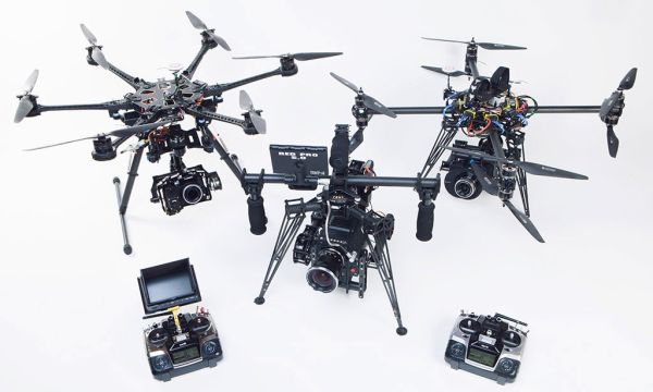
A company holds a patent for coaxial drone multirotors, locals push back on Amazon’s delivery plans, autonomous battery swapping, transforming battlefield medicine, drones in sports, saving elm trees, and investigating environmental polluters with drones.
Nordic Unmanned has a patent for coaxial configuration on a drone. (Where two motors operate on the same axis, rotating in opposite directions.) The company will license the concept as a product. For more, see Nordic Unmanned – Coaxial Configuration Patent.
Amazon recently announced they would begin delivering packages by drone in the United States. Six months ago the company notified local authorities in unincorporated Lockeford, California. The drone facility is under construction, but residents are just hearing about it now and are not all supportive.
Airrow is an LA-based startup developing an autonomous device that swaps drone batteries and payloads. They say, “The biggest problem with drones today is the manual labor behind each drone’s ground operation.” Airrow believes that up to 80% of the daily operational costs for drones can be eliminated by “removing human labor from the mundane job of servicing a drone’s routine operation.” They call their solution Dronehub.
In combat operations, one significant way to save lives is to provide blood products to forward-deployed medics and corpsmen quickly. Blood loss (or “bleeding out”) is reported to be the leading cause of preventable death on the battlefield. Drones could offer a way to deliver blood products quickly.
Dutch elm disease has devastated elm trees in a number of countries. Volatus Aerospace wants to use drones to identify the disease earlier than is usually the case. The drones can fly through an area and use a machine-learning algorithm to identify suspect trees. The traditional ground-based assessment is slow and costly.
The non-profit Waterkeeper Alliance is a global network of clean water groups. They are training activists to use drones for storytelling and evidence collection while investigating suspected violations of the Clean Air Act.
The FAA has new recreational drone restrictions, along with exceptions for those that cannot be presently met. Also, drones that identify polluting ships, data security fears for Chinese drones, professional sports leagues weigh-in on drones, UAS that measure environmental conditions for weather prediction, and states in the US are actively using unmanned aircraft.
The FAA Reauthorization Act of 2018 repealed the Special Rule for Model Aircraft and replaced it with “new conditions to operate recreational small unmanned aircraft without requirements for FAA certification or operating authority.” Recreational drone users must meet eight statutory conditions. However, since the FAA cannot implement all of them immediately, exceptions were published in the Federal Register May 17, 2019, as Exception for Limited Recreational Operations of Unmanned Aircraft.
The eight conditions, and where exceptions apply:
1. The aircraft is flown strictly for recreational purposes.
2. The aircraft is operated in accordance with or within the programming of a community-based organization’s set of safety guidelines that are developed in coordination with the FAA.
The Act requires the FAA to establish guidelines for recognizing community-based aeromodelling organizations (CBOs). Since those guidelines don’t exist and CBOs thus cannot be recognized, the FAA will allow “operations conducted in accordance with existing safety guidelines of an aeromodelling organization.” As an alternative, the basic safety guidelines published in faa.gov/uas are sufficient. But, you “should be able to explain to an FAA inspector or law enforcement official which safety guidelines you are following if you are flying under the exception for limited recreational unmanned aircraft operations.”
3. The aircraft is flown within the visual line of sight of the person operating the aircraft or a visual observer co-located and in direct communication with the operator.
The visual observer is optional unless flying FPV and the operator can’t see the surroundings.
4. The aircraft is operated in a manner that does not interfere with and gives way to any manned aircraft.
5. In Class B, Class C, or Class D airspace [controlled airspace] or within the lateral boundaries of the surface area of Class E airspace designated for an airport, the operator obtains prior authorization from the Administrator or designee before operating and complies with all airspace restrictions and prohibitions.
Until Low Altitude Authorization and Notification Capability (LAANC) is upgraded to enable recreational flyers to obtain automated authorization to controlled airspace, the FAA is granting temporary airspace authorizations to operate at certain fixed sites that are established by an agreement with the FAA. The list of authorized fixed sites is available on the FAA’s website.
6. In Class G airspace, [uncontrolled airspace where the FAA does not provide air traffic services] the aircraft is flown from the surface to not more than 400 feet above ground level and complies with all airspace restrictions and prohibitions.
7. The operator has passed an aeronautical knowledge and safety test and maintains proof of test passage to be made available to the Administrator or a designee of the Administrator or law enforcement upon request.
The test doesn’t yet exist. Recreational flyers who adhere to the other seven conditions may use the exception for limited recreational unmanned aircraft operations.
8. The aircraft is registered and marked and proof of registration is made available to the Administrator or a designee of the Administrator or law enforcement upon request.
Registration and marking requirements are published and an online registration process is in place. Each unmanned aircraft used for limited recreational operations must display the registration number on an external surface of the aircraft. Proof of registration must be available upon request.
New regulations apply to air pollution from ships, specifically sulfur oxides. Drones are being tested or used in ports around the world. These will quickly fly through a ships exhaust plume and measure the emissions. If a “dirty” ship is encountered, that vessel can be singled out for a test of its fuel. The Skeldar V-200 drone is an example.
The US Department of Homeland Security issued an alert through the Cybersecurity and Infrastructure Security Agency that says the drones “contain components that can compromise your data and share your information on a server accessed beyond the company itself.” Further, that “…certain Chinese-made (unmanned aircraft systems)-connected devices capable of collecting and transferring potentially revealing data about their operations and the individuals and entities operating them, as China imposes unusually stringent obligations on its citizens to support national intelligence activities.”
DJIsaid that it gives customers “full and complete control over how their data is collected, stored, and transmitted,” adding that “customers can enable all the precautions DHS recommends.”
Through the NPRM commenting process, the NFL, MLB, NASCAR, and NCAA have expressed concerns. The Leagues want to see the rules explicitly state that UAS operations at night comply with rules applicable to aircraft. Also, they want to see the requirement that pilots make their credentials available to law enforcement expanded to include private security officials.
The American Association of State Highway and Transportation Officials found all but one State public transportation agency was using drones. (Rhode Island wasn’t, but since then they bought a drone.) In 2016, no state transportation agency was using drones every day. Now, 36 states have certified drone pilots on staff.
This is a project with the National Severe Storms Laboratory, the University of Oklahoma, the University of Colorado, and Meteomatics. Researchers used fixed-wing and rotary small UAS in Oklahoma to test the value of UAS for observing local environmental changes that can lead to severe thunderstorms.
HeliVideo to cover U.S. Open, commercial drone market share, China uses drone to catch cheaters, using TV signals to sense aircraft, a Google drone patent, and UAS full type certificates.
FOX Sports is using octocopters from Austin-based HeliVideo to cover the golf championship at Chambers Bay. HeliVideo says they provide “FAA approved cinematography for television and film.” The HeliVideo fleet includes a Small Sensor Hexacopter with a Panasonic Lumix GH3, a Full Frame Octocopter sporting a Canon 5D Mark 3, an EPIC 6k Dragon Octocopter, and an EPIC 6k Dragon Single blade helicopter.
For the golf tournament, HeliVideo is bringing a four-man team and more than $1 million in equipment — including the DJI Spreading Wings 1000 drone. HeliVideo received their exemption last September. An authorized, licensed pilot will fly the drones, while a visual observer will keep tabs on the devices at all times.
sUAS News reports that DJI has 48.4% of the “commercially licenced platforms” in service. AeroVironment follows with 12.1%, 3DR with 7.6%, and Precision Hawk with 3.9% This is from a total population of 380 platforms.
The National College Entrance Exams in China are critical to the future success of the 9.5 million students who take the 2-3 day test. This has led to cheating schemes where students send exam questions out to others, who then transmit answers back to the student.
Now Chinese education authorities are fighting back with a drone. It flies over testing centers and scans for signals being sent to devices brought in by students. The drone is reported to be about the size of a gas station pump and cost tens of thousands of dollars.
Air traffic control company NATS has been working with Thales and contract R&D company Roke Manor to see if television transmission signals could be used to detect and direct aircraft. In a trial conducted over London, more than 30 aircraft were tracked at altitudes of up to 10,000 feet.
Google was granted United States Patent 9,051,043 titled “Providing emergency medical services using unmanned aerial vehicles.” It provides for a fleet of UAVs configured to: identify remote medical situations, determine the target location, select a UAV with the proper configuration, and deploy the UAV to the target location to provide medical support. Sounds a lot like the Amazon drone delivery patent.
A type certificate would allow a UAS manufacturer to fly the aircraft throughout U.S. airspace. Larger UASs like the Boeing Insitu ScanEagle and AeroVironment’s Puma fly under type certificates issued in the Restricted category. Experimental type certificates have been issued to other UASs which generally prohibit commercial uses. There are no type certificate requirements for UASs under 55 pounds.
A new FAA policy streamlines the Certificate of Waiver or Authorization (COA) process, an unmanned aircraft Business Park is born, a Senator proposes a “Commercial UAV Modernization Act,” and drones used at a golf tournament, or not.
The FAA says they will grant a Certificate of Waiver or Authorization (COA) for “flights at or below 200 feet to any UAS operator with a Section 333 exemption for aircraft that weigh less than 55 pounds, operate during daytime Visual Flight Rules (VFR) conditions, operate within visual line of sight (VLOS) of the pilots, and stay certain distances away from airports or heliports.”
Claimed to be “the first commercial UAS Business and Aviation Park in the nation,” Grand Sky is open and taking applications for build-to-suit site occupancy. Located on Grand Forks AFB, and executed in partnership with Grand Forks County, North Dakota, Grand Sky is looking for tenants and owner occupants who will engage in UAS testing, evaluation, research, development, and operations.
In an effort to prevent drones from interfering with the Masters Golf Tournament in Augusta, Georgia, commissioners approved a county-wide ban on launching or operating drones between April 2 and April 13. Prior to being amended, the ban originally would have affected all drones at any time in areas with dwellings, congested areas, at sporting events, and in heavily populated parks.
The author of this article proposes the use of geo-fencing, detection and tracking systems for high security areas, and interceptor drones with nets to capture invading drones.
Senator Booker’s proposed “Commercial UAV Modernization Act” is meant to allow certain commercial operations until the final FAA regulations are issued. These temporary rules would allow sUAS to perform missions such as construction site surveys or crop mapping. The bill also calls for a new “Deputy Associate Administrator for Unmanned Aircraft” to report to the head of the FAA and the Secretary of Transportation.
Victor Villegas, aka DroneSinger, calls himself the “Weird Al” Yankovic of drones. He creates drone songs to bring attention to drone issues and drone culture. This musical parody song encourages drone fans to comment on the FAA’s NPRM for commercial use of sUAS.
@dronemama says: Be sure to read and comment on the NPRM.
NPRM update, a drone at a baseball spring training camp, researching the effects of drones on birds, rooftop inspections by UAVs, the Piaggio P.1HH HammerHead prototype maiden flight, Europeans work to harmonize UAV guidelines, and drones that communicate with ATC by voice.
FAA sUAS NPRM
The Operation and Certification of Small Unmanned Aircraft Systems NPRM was released February 15, 2015 and published in the Federal Register February 23, 2015, starting the 60 day clock for public comments. Comments must be received by April 25, 2015.
A player on the Cleveland Indians baseball team brought a drone to the team’s spring training camp and took some aerial photos. The MLB shut him down, probably because the ball field is next to Phoenix Goodyear Airport
To study the effects of drones on wildlife, researchers flew a quadcopter near eating or resting birds more than 200 times. They tried different speeds and angles of attack and looked for signs of stress.
They found that if you stayed 15 feet away, the birds didn’t much care about the quadcopter. Frequency of approach didn’t matter and color of the drone didn’t matter. However, approaches from directly above did upset the birds.
Ideas for future study include rotary vs. fixed wing drones, drone size, and sound of the drone. Also, stress indicators for other species may not be visual.
Outside of Boston, the town of Somerville has hired an aerial cinematography and multimedia company to fly drones over municipal buildings to inspect for excessive snow.
Above Summit is providing an alternative to sending workers up to look for dangerous snow accumulations. They inspected 10 buildings in one day alone.
Piaggio Aerospace conducted the maiden flight of the P.1HH HammerHead prototype. The medium-altitude, long-endurance (MALE) HammerHead is derived from the Avanti II twin-pusher turboprop.
Piaggio Aerospace chief executive Carlo Logli said, “Today we have compelling reasons to believe that P.1HH will become the first European state-of-the-art MALE UAS, uniquely suited to perform a wide range of surveillance and security missions at the highest technological level.”
The vehicle management control system, sensors, data link, and ground control station come from Selex ES. Missions include border control, wide area and targeted surveillance, and humanitarian assistance.
The European Commission and ICAO (International Civil Aviation Organization) believe that current air traffic management systems will not adapt to UAVs. Instead, unmanned systems will have to feed the air traffic control we already have today. If that’s going to work, then unmanned air vehicle regulations need to be more globally aligned.
The Single European Sky ATM Research (SESAR) Joint Undertaking (SJU) initiative includes a strategy to modernise and harmonise UAV operations. An upcoming RPAS element in SESAR’s strategy will facilitate this further.
Researchers at RMIT University in Australia have developed a system that lets drones communicate with air traffic controllers using a synthesized voice. This is being conducted with Thales’ Centre for Advanced Studies in Air Traffic Management (CASIA), and UFA Inc., a software engineering firm.
The system uses UFA’s ATVoice® Automated Voice Recognition and Response software. With it, drones can verbally respond to spoken information requests over the radio, and even act on clearances from air traffic controllers.
ATVoice is used in flight simulators which allow “the user to control the simulation exercise through voice commands using standard FAA or ICAO air traffic control phraseology,” according to UFA.
Video of the Week
“The Drones” is Audi’s new commercial which re-creates Hitchcock’s The Birds using flocks of multicopters as the evil intimidators.
FAA progress in meeting the UAS mandate, an update on plans at the Griffiss International Airport UAS test site, a former United States governor is hiding from the drones, a system to monitor river environments, maintaining UAS control in the airspace with satellites, and drones at the Olympics.
A Congressional hearing was held to check on the progress made by the FAA in meeting the roughly 200 mandates of the FAA Modernization and Reform Act of 2012. The FAA is behind schedule on the Next Generation Air Transportation System (NextGen) and integration of UAS into the national airspace system.
A panel has described the activities expected at the UAS test site at Griffiss International Airport in upstate New York. This site is a partnership between Griffiss and the Northeast UAS Airspace Integration Research Alliance (NUAIR) based in Syracuse.
Testing at Griffiss will begin around April 1, with a focus on agricultural, not military applications. Flyterra (@Flyterra on Twitter) will be the first commercial flyer of drones at the base, and they expect to test for about eight months.
Jesse Ventura is a former professional wrestler, Minnesota Mayor and Governor, actor, and current host of the Conspiracy Theory television series. He says he’s “gone off the grid” down in Mexico. Why? So the drones can’t find him.
A system that combines a multi-rotor UAV with an autonomous surface vehicle (ASV) has been developed for environmental monitoring of rivers. The “Riverwatch” system automatically measures conditions above the water, below the water, and on the surface.
The six-rotor UAV is based on the VBrain from the Italian company Virtualrobotix. It uses open-source control software and hardware, and has a FLIR Quark 336 thermal imaging camera equipped with a GoPro Hero 3 WiFi camera, and a webcam.
The DeSIRE project (Demonstration of Satellites enabling the Insertion of Remotely Piloted Aircraft Systems in Europe) looks to test UAS control via satellite communications. The European Defense Agency (EDA) and European Space Agency (ESA) will cooperate to demonstrate that UAS can operate commercial and government missions beyond radio line-of-sight using satellite-based command-and-control data links.