Podcast: Play in new window | Download (Duration: 33:31 — 23.0MB)
First responder tactical beyond visual line of sight (TBVLOS) waivers, 100,000 Wing deliveries in Australia, using Starlink for military maritime intelligence drones, DJI Mavic 3 leaked, measuring the wind for UAM safety, a drone services company meets a UAV maintenance provider, and the history of drones in Southeast Asia
UAV News
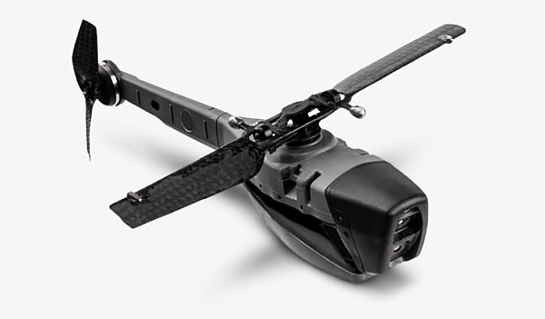
Paladin publicly launches Knighthawk, a first response drone for cities
Paladin has unveiled its custom Knighthawk and Watchtower products for first responders. The startup has built autonomous systems for cities that can be deployed to 911 calls and provide instant situational awareness. The Knighthawk drone has a 10x zoom optical camera and a thermal camera to provide video feeds day and night. The Watchtower software is available as an app. Since 2018, the company has responded to about 1,600 emergencies in Texas and Ohio.
Paladin has “First Responder Tactical Beyond Visual Line of Sight” (TBVLOS) [PDF] operating waivers from the FAA. These temporary BVLOS flights are flown to both reduce risk to first responders and to ensure the safety of the communities they serve. The waiver has a number of specific conditions and requirements.
Wing approaches 100,000 drone deliveries two years after Logan, Australia launch
In the first week of August alone, customers in Logan, Australia placed 4,500 orders – one every 30 seconds during Wing’s delivery window. The Wing drones delivered 10,000 cups of coffee, 1,700 children’s snack packs, 1,200 hot chooks (roasted chicken, in Australia), 2,700 sushi rolls, and 1,000 loaves of bread. Wing expects the service to expand into other markets in the coming months, including Australia, Finland, and the United States.
Drones and Starlink: Combining Satellite Constellations With Unmanned Navy Ships
The United States Navy faces an aging fleet of transport ships and personnel shortages. Autonomous maritime vessels could be a solution, as well as semi-autonomous drones that could act as a screening force for operations, provide an extended sensor net, and provide greater tactical awareness. The new SpaceX Starlink satellite constellation might provide easy and reliable connectivity for a globally operated network of maritime drones.
DJI Mavic 3 leaks with new cameras, a larger battery and longer flight times
A YouTuber leaked what is believed to be the next Mavic drone. It features improved obstacle detection utilizing new wide-angle lenses on the front and rear cameras, the main camera with a focal length equivalent to 24 mm, and an f/2.8 aperture, a second camera that supports up to 7x optical zoom, images stored on 1 TB of internal memory, and a larger battery providing up to 40 minutes of flight time.
NASA taps Kyoto startup to make maps of the wind for drones
NASA wants maps of the wind so drones and air taxis will be safer. Japanese startup MetroWeather Co. LiDAR sensors track atmospheric dust to measure wind direction and speed. MetroWeather sensors will be used by US-based TruWeather Solutions Inc. at a NASA drone testing site to show how real-time wind information can help drones choose optimal routes that avoid wind shear and other dangers.
Carbonix Partners with Robotic Skies to Advance Global Field Support
Robotic Skies, Inc provides maintenance, inspection, and repair services for the commercial drone industry with over 230 Service Centers in 50 countries. Carbonix is an Australian company with data capture UAVs for long-range and large-area aerial surveillance. The two companies are partnering to provide an international field support program for customers who operate Carbonix UAVs.
Inside Vietnam’s Forgotten Drone War
Drones played an important role in the Vietnam War target spotting for bombers, jamming radars, and dropping propaganda leaflets. The new nonfiction book Drone War: Vietnam explores that history.
UAV Video of the Week
Watch: Alligator Eats Drone In Video Shared By Sundar Pichai
An inexperienced drone operator in Florida flew his drone too close to an alligator, with serious consequences.