Podcast: Play in new window | Download (Duration: 30:28 — 21.0MB)
Max and @dronemama visit Smith College and talk to the summer drone class, 3DR and DJI join resources, drones assist with invasive snakes, Farmers Insurance expands the use of UAS, and a drone privacy spat on Twitter.
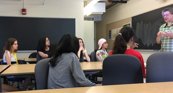
Max speaks with students at the Smith College Drone Class.
Drone Class at Smith College
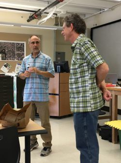
Jon Caris, Director at Smith College Spatial Analysis Lab (L) and Max.
Max spoke to the SSEP Drone Class at Smith College in Northampton, Massachusetts. The class is part of the College’s Summer Science and Engineering Program (SSEP), a four-week residential program for exceptional young women with strong interests in science, engineering, and medicine. High school students from across the United States and abroad do hands-on research with Smith faculty in the life and physical sciences and in engineering.
The young women are building quadcopters in the Smith College Spatial Analysis Lab where they learn about drone laws and regulations, applications of the technology, flight mechanics and piloting skills, photogrammetry and image processing, and of course drone safety. The students are highly engaged, and this program is a wonderful opportunity for them.
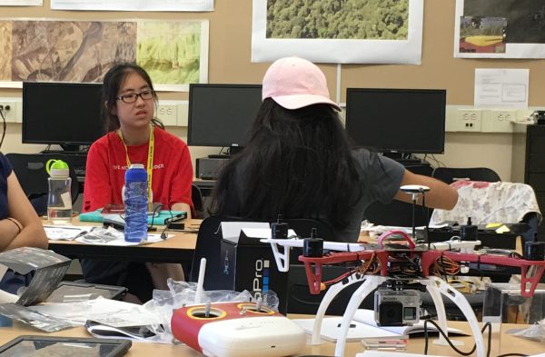
Smith College drone class students.
UAV News
America’s top drone company couldn’t beat China’s DJI, so now they’re partners
3D Robotics announced that they are entering into a partnership with DJI and will integrate their Site Scan software with DJI drones. This is an enterprise solution for industries like construction, insurance, surveying & mapping, utilities, and telecom. Sales at 3DR were not up to expectations and the company consumed $100M in venture capital trying to compete. Now, 3DR will focus on software instead of hardware.
3DR Site Scan data capture technology can use 3DR (with Sony R10C) or DJI (Phantom 4 Pro) vehicles and operate in four autonomous flight modes for data capture. Data is uploaded to the cloud and can be processed by Pix4D and Autodesk ReCap. The service includes complimentary drone replacement for accidents and malfunctions.
VolAero Drones Starts Python Tracking Project In Everglades Using Thermal Technology
The population of non-native Burmese pythons in the Florida Everglades has exploded to the point where they are a threat to the small mammal population. The Florida Fish and Wildlife Conservation Commission and the South Florida Water Management District are now looking to professional drone services company VolAero Drones and drone imaging technologies to help manage the situation.
Farmers Insurance launches drone program with Kespry
Farmers Insurance is expanding their use of UAS for residential property damage assessments. The company is looking for faster inspection times with fewer safety risks for field adjusters. Drones from Kespry will “gather rooftop imagery and data, generate analytic reports, supplement ladder assist capabilities, and resolve more claims with greater efficiency and accuracy.” The FAA-licensed drone operators will be Farmers’ own claims professionals.
Kentucky governor says news station drone invaded privacy
Gov. Matt Bevin tweeted: “The drone that was just flying over my home & filming my children was personally flown by @WDRBNews Director.” WDRB news director Barry Fulmer followed with his own tweet: “.@GovMattBevin WDRB was flying a drone in accordance to the FAA rules to cover news happening at your home. There is NO video of children.”
UAV Video of the Week
Drone captures mesmerizing footage of hundreds of fish on pink salmon run
Video captured by Danny Sanford in Hartney Bay in Cordova, Alaska.