Tag Archives: DARPA

UAV231 The Drone Services Industry

The changing landscape for drone services, drone swarms for urban tactics, a simulated drone attack in Idaho, European airport operators embrace the value of drones but look for protections, MIT develops a mapping system for drone navigation, the Department of the Interior uses UAVs with great results, and Intel at the Olympics.

UAV News

Here’s Why The Drone Services Industry is in Trouble

In the “old” days, the Section 333 process was long and difficult. The hardware was tricky to operate and getting data from the drone was not easy. So companies used drone service providers to accomplish the desired missions. Now, a Part 107 is easy and cheap to obtain, flying drones is easier, and data from the drone is not as difficult to acquire. This means companies can create their own in-house drone capability.

PrecisionHawk Acquires Droners.io and AirVid to Launch the Nation’s Largest Network of Commercially Licensed Drone Pilots

PrecisionHawk has acquired Droners.io and AirVid to deliver on-demand, drone-based imagery to enterprise clients. The companies will merge and operate under the Droners.io name. Combined, they form a network of more than 15,000 commercially licensed drone pilots, which PrecisionHawk will use to service its enterprise customers in insurance, agriculture, energy, construction, and government. Part 107 certified pilots can join the network and start accepting jobs in their region by creating a profile at www.droners.io.

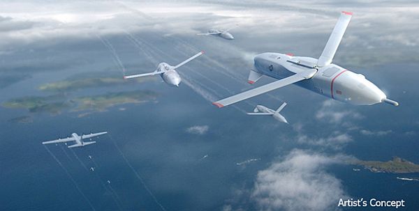
Participants wanted for UAV swarm-based tactics test bed

Northrop Grumman is the Phase 1 Swarm Systems Integrator for the DARPA OFFSET program (OFFensive Swarm-Enabled Tactics). The program “envisions future small-unit infantry forces using swarms comprising upwards of 250 small unmanned aircraft systems (UASs) and/or small unmanned ground systems (UGSs) to accomplish diverse missions in complex urban environments.” Northrop Grumman is about to launch its first open-architecture test bed and they are looking for participants to create and test their own swarm-based tactics on the platform.

Idaho Technology Company Black Sage Plans Drone Defense Demonstration at Idaho State Capitol

On February 21, 2018, Boise, Idaho-based Black Sage plans to demonstrate a drone defense system as they create a drone attack on the state capitol. Black Sage will create a virtual fence around the capitol, fly a swarm of drones directly into the protected area, and demonstrate the counter-UAS system to safely defeat the threat.

European airport operators call for adoption of drone rulebook

Airport Council International for Europe (ACI Europe) says safety issues involving drones and airports are increasing, and they want to see “an effective regulatory framework.” ACI Europe released the 6-page position paper on drone technology, ACI Europe Position on Drone Technology [PDF] in January. The paper recommends:

    • Airport-specific protection policies, including standardized protected zones
    • Technical systems to detect and neutralize drones
    • Traffic management for drone operations at airports
    • Readying the airport industry for future drone technology opportunities.

MIT teaches drones to fly with uncertainty

MIT researchers are developing the NanoMap system for drones. The system navigates a drone from point to point while avoiding random obstacles. Where other models have the drone map the environment, then fly through it, NanoMap creates maps on the fly.

Interior’s magic bullet: Drones that are DoD castoffs

The Department of Interior has a fleet of drones, many of which are hand-me-downs from the Department of Defense. Nevertheless, the drones are performing tasks that take one-seventh the time at one-tenth the cost, such as: land surveillance, wildlife monitoring, assistance with natural disasters, and dam inspections.

UAV Videos of the Week

High-tech drones steal the show at the Winter Olympics

Intel | The Tech Behind a Record-breaking Drone Show at PyeongChang 2018

https://youtu.be/wFi5SkhUjR8

Mentioned

Questions remain after drone collides with helicopter on Kauai


UAV225 DARPA Gremlins

DARPA Gremlins advance reusable drone technology, North Carolina plans UAS workshops for public safety agencies, Seaglider underwater drones set to explore Antarctic ice shelves, fuel cell propulsion systems will be integrated into the ScanEagle, and medical package delivery drones are successful in Africa.

DARPA Gremlins launched from a C-130.

DARPA Gremlins launched from a C-130. DARPA image.

UAV News

Air Force Could Test “Flying Aircraft Carriers” as Early as Next Year

The U.S. Defense Advanced Research Projects Agency (DARPA) Gremlins program envisions small, reusable drones that can be launched from a C-130 inflight to surveil or attack targets as much as 300 miles away. The Gremlins then return to their flying airbase and are flown back to home base where there are prepared for their next mission.

In Phase 2, DARPA will review Gremlin prototypes from Dynetics and General Atomics. In Phase 3 DARPA will select one of the two prototypes for a “full-scale technology demonstration system” that will be test-flown in 2019.

North Carolina government plans drone workshops for 2018

The North Carolina Department of Transportation is planning free UAS/Drone workshops for public safety agencies. The purpose of the workshops is to educate agencies on the safe and beneficial uses of drones, provide updates on the latest federal and state regulations, and provide best practices for safe operations and data management. The Operating Unmanned Aircraft Systems (UAS) in North Carolina web page contains a downloadable 47-page safety guide [PDF] and an online knowledge test.

Drones Are Diving Under Antarctic Ice to Map Unseen Portions of Our World

The University of Washington in Seattle is planning to use seven underwater robots to explore an Antarctic ice shelf. Three Seaglider self-propelled drones “swim” by adjusting their buoyancy and using mechanic “wings.” The Seaglider Fabrication Center, a division of the School of Oceanography in the College of the Environment, provides Deepgliders™, Seagliders™, operator training, and glider refurbishment. Under a license agreement with Kongsberg Underwater Technologies, Inc. (KUTI), the University can only produce Seagliders for customers inside the University of Washington.

Earth Under Water is a 45 minute National Geographic program that looks at the worldwide rise in sea levels.

Drone Operator Sues Blackhawk Pilot for Destroying Drone over Staten Island

Maybe. The Aviation Acorn treads a bit into the realm of The Onion.

Ballard, Insitu partner on UAS fuel cell propulsion system

Ballard Power Systems is working with Insitu to develop a next-generation fuel cell propulsion system for the ScanEagle UAS. The 1.3-kilowatt system for small unmanned fixed-wing and vertical-take-off-and-landing (VTOL) drones will be integrated into the ScanEagle platform.

‘Uber for blood’: how Rwandan delivery robots are saving lives

As an update to our report in Episode 146 about medical package delivery in Rwanda, we see that the Rwandan health ministry has delivered more than 5,500 units of blood over the past year using Zipline drones. Delivery times to remote regions of Rwanda have been cut from four hours to an average of half an hour. Now Zipline plans to launch what it claims is the world’s largest drone delivery network, working with the government of Tanzania.

UAV Video of the Week

Zipline

This video shows how medical package deliveries with Zipline drones save lives in Rwanda.

https://youtu.be/6wBeXIgD4sY


UAV197 NASA UAS Traffic Management (UTM) System Tests

NASA UAS Traffic Management system testing at the UAS test sites, Arizona law enforcement uses a drone to find a missing man, a drone company becomes a drone data company, DARPA studies mid-flight multitasking for small drones, a University of Calgary study of drone incidents, and fuel cells for drones.

The Kespry fully autonomous aerial intelligence system

The Kespry fully autonomous aerial intelligence system. Image courtesy Kespry.

UAV News

NIAS and NASA test the Next Phase of NASA’s UAS Traffic Management System

Tests for NASA’s Unmanned Aircraft System (UAS) Traffic Management (UTM) system are being conducted at the six UAS test sites in the “Technology Capability Level 2 (TCL2) National Campaign.” The first tests were held at the Nevada Institute for Autonomous Systems.

NCSO uses UAV to find missing man

After receiving a call about a man who was missing in the woods, the Navajo County Sheriff’s Office in Arizona deployed their drone for the search. The disoriented man was found in about 45 minutes.

Transforming a Drone Company into a Data Company

Kespry says they are “focused on making it easy to capture, process, use and share high-resolution information from the field.” They offer “a fully autonomous aerial intelligence system” that tries to eliminate the need to integrate multiple systems from multiple vendors. In effect, their complete drone solution makes them more of a data company than a drone company.”

DARPA program to allow for mid-flight multitasking drone missions

A small UAS can often carry only one payload due to power, weight, and size constraints. Under the CONverged Collaborative Elements for RF Task Operations (CONCERTO) program, DARPA is looking at multiple payloads that share common RF components. BAE Systems has been awarded $5.4 million in contracts to help develop technology that allows operating modes to switch mid-flight. See the video: CONCERTO Concept of Operations

Close encounters of the drone kind becoming more common, U of C study says.

A new University of Calgary study finds there are more drones in the air than manned aircraft. There were 355 drone incidents reported in Canadian airspace between November 2005 and December 2016, and 22% of them involved close encounters between drones and piloted aircraft. Most incidents involve non-licensed operators.

Will Hydrogen Fuel Cells Help Drones Stay in the Air?

Three options today for increasing electric UAV time-in-the-air are tethered devices, solar power, and in-the-field rapid battery replacements. However, fuel cell power systems are gathering steam and two private companies are innovating and offering products: Protonex, based in Massachusetts, is focused on Proton Exchange Membrane (PEM) technology for small, light UAV applications; China-based MMC is currently manufacturing and distributing two models of fuel cells.

UAV Videos of the Week

Playing Pong with Drones

3DR Interns Ian McNanie and Josh Jacobs have programmed a group of drones to play a game of pong in the air. One base station communicates with the swarm of drones.

Brad Byrd – Highest Mountain

The Highest Mountain music video from singer/songwriter Brad Byrd was shot and directed by Dylan Kussman (Dead Poets Society, Jack Reacher, X-men) using DJI Zenmuse X5 video drones.

Mentioned

Nova Systems Completes Multi-drone UTM Trial

Unmanned Aerial System (UAS) Traffic Management (UTM) system trials are taking place in Australia. The trial that Nova Systems participated in explored different Remotely Piloted Aircraft types and sizes, payload capabilities (including live payload distribution over an LTE network), the effectiveness of each UTM (some of which relied upon the LTE network), control of drones over the LTE network, and a new approach to range safety.

Drone Problems

A humorous cartoon from XKCD about drone operators who seem to crash a lot.


UAV117 Don’t Fly UAS Near Airports

SkyPan International

FAA proposes $1.9 million penalty against UAS operator, Pathfinder expanded to detect UAS near airports, NAV Canada wants jail time for flying near airports, detect-and-avoid standards on the way, Boeing tests joined wing body UAS, and DARPA working to develop vanishing drones.

News

FAA Proposes $1.9 Million Civil Penalty Against SkyPan International for Allegedly Unauthorized Unmanned Aircraft Operations

The FAA says aerial photography company SkyPan International “conducted 65 unauthorized operations in some of our most congested airspace and heavily populated cities, violating airspace regulations and various operating rules.” Forty-three of the flights flew in restricted Class B airspace near airports.

According to the FAA, SkyPan flew commercial UAS flights over New York City and Chicago between March 21, 2012 and Dec. 15, 2014 without an aircraft airworthiness certificate, registration, or a Certificate of Waiver or Authorization.

In UAS expert: FAA’s proposed $1.9 million fine is necessary, Christina Engh, the chief operating officer for consulting firm UASolutions Group Inc. said the FAA’s actions should serve as a warning to the industry.

On its website, SkyPan says they have been operating safely for 27 years. They operate only over the private property of clients with single rotor aircraft capable of controlled autorotation descent, and “SkyPan robots are repeatedly tested and were inspected by the FAA in August 2013, deemed to be one of the safest UAV operations in the USA.”

Additionally, SkyPan says they “proactively contacted the FAA in 2005, 2008, and 2010 to explore special permitting for its commercial UAS activity, by discussing regulatory and suggested technical parameters with FAA officials in Illinois, New York and Washington, D.C. and in 2015 was awarded a ‘333’ exemption to the FAA’s blanket ban on commercial UAS operation.”

FAA Expands Unmanned Aircraft Pathfinder Efforts

The FAA entered into a Pathfinder agreement with CACI International Inc. to evaluate how the company’s sensor technology can help detect UAS in the vicinity of airports.

The FAA’s UAS Pathfinder initiative creates research partnerships with industry to explore next steps beyond the types of operations described in the sUAS NPRM.

John Mengucci, CACI’s Chief Operating Officer and President of U.S. Operations said, “The agreement provides a proven way to passively detect, identify, and track UAS… and their ground-based operators, in order to protect airspace from inadvertent or unlawful misuse of drones near U.S. airports.”

The FAA will select airports where CACI’s prototype UAS sensor detection system will be evaluated at airports.

NAV Canada CEO: ‘Jail time’ needed for reckless UAV operators

Speaking about recreational UAVs flown within 5 miles of airports, NAV Canada president and CEO John Crichton said operators should be subject to criminal penalties. “Why don’t we go out and catch a few people?” he said.

First Interim Standards for Unmanned Aircraft Detect-and-Avoid Released

An RTCA Special Committee released interim minimum operational performance standards (MOPS) for the detect-and-avoid system and command-and-control data link. The RTCA is chartered by the FAA to operate Federal advisory committees. It develops minimum performance standards that form the basis for FAA regulatory requirements.

The performance standards don’t apply to sUAS, only to civil UAVs flying to and from Class A controlled airspace (above 18,000 ft.) under instrument flight rules. The MOPS specifies sensors to detect other aircraft and provide operators on the ground with awareness and guidance. It’s run with ADS-B, TCAS, and radar. Release of the final document release is planned for 2016.

A uniquely shaped unmanned aerial vehicle undergoes tests

Boeing is testing a rigid wing version of a joined-wing UAV. Ultimately, a flexible wing version is planned for long duration surveillance missions.

The Military’s ICARUS Project Wants To Build Delivery Drones That Vanish Into Thin Air

Under DARPA’s Vanishing Programmable Resources (VAPR) program, “degradable” electronic systems physically disappear in a controlled, triggerable manner to prevent them from being captured by enemies. The DARPA Inbound Controlled Air-Releasable Unrecoverable Systems (ICARUS) project builds on VAPR to create drones that disappear after completing their mission.

How? With “polymer panels that sublimate directly from a solid phase to a gas phase, and electronics-bearing glass strips with high-stress inner anatomies that can be readily triggered to shatter into ultra-fine particles after use.”

Mentioned

Police: Drone crashes, burns in Sag Harbor

A multirotor burned on the sidewalk after crashing into two buildings.

UK firms develop drone-freezing ray

The Anti-UAV Defense System (AUDS) jams the communications signal for a drone, making it unresponsive.

Anti-drone rifle shoots down UAVs with radio waves

Battelle’s DroneDefenderTM is a “rapid-to-use counter-weapon to stop suspicious or hostile drones in flight.”

Senate bill criminalizes ‘reckless’ drone flights

The Safe Drone Act from Sen. Barbara Boxer (D-Calif.) would make it a crime to fly recklessly near restricted airspace.

Polish Air Force F-16 Jet Collided with Drone

Ground crews discovered damage to the airframe protective coating and to the fuel tank during post-flight checks.

Drone activity ‘raises risk’ for pilots, firefighters as bush-fire season nears

With the annual bush-fire season approaching in Australia, authorities there are concerned about people flying drones near bush-fires.


UAV091 Here Come the Lawyers

ECA Group Mini UAVLaw firms step up to UAVs, DARPA enlists Northrop Grumman and AeroVironment for TERN, the MQ-4C Triton UAS gets new search radar, the X-47B refuels autonomously, agricultural applications for UAVs, an anti-drone drone, detecting drones by sound, and the FAA clarifies policy for drone online videos.

News

US firms rush to set up drone departments

Michael Drobac is executive director of the Small UAV Coalition, but also the senior policy advisor at Akin Gump Strauss Hauer & Feld. He says, “’Almost every firm has a drone practice. I’m not sure every firm has a drone client.”

273 Drone Aircraft Carriers? New DARPA Contract Could Be a Game Changer

The Pentagon’s Defense Advanced Research Projects Agency (DARPA) wants the Navy to be able to launch MALE-class drones from ships at sea. Under the Tactically Exploited Reconnaissance Node, or TERN program, Northrop Grumman and AeroVironment have been selected to compete the next phase of the program and create systems where unmanned aircraft “take off and land from very confined spaces in elevated sea states and … to transition to efficient long-duration cruise missions.”

Triton UAS conducts first flight with search radar

The Navy’s MQ-4C Triton UAS has completed its inaugural flight with the new Multi-Function Active Sensor (MFAS) search radar. The radar has all-weather capability and provides a 360-degree view of a large geographic area. When operational, the Triton will dwell at high altitudes and provide 24/7 ISR coverage virtually anywhere in the world.

Fueled in flight: X-47B first to complete autonomous aerial refueling

X-47B completes first autonomous aerial refueling

On April 22. 2015 the first ever Autonomous Aerial Refueling (AAR) of an unmanned aircraft was accomplished with the X-47B. This completed the final test objective under the Navy’s Unmanned Combat Air System (UCAS) demonstration program. The aerial refueling was captured on video.

Researchers Seeking Agricultural Applications For Unmanned Aircraft

The University of Florida Citrus Research and Education Center recently hosted the HLB Grower Day and UAV Applications in Agriculture Workshop to look at future applications of UAVs in agriculture. The workshop was coordinated by Dr. Reza Ehsani, Associate Professor, Agricultural and Biological Engineering.

Noting that commercial operations are not yet generally allowed by the FAA, Ehsani said, “It will take at least a year until the proposed rules go through all of the approval process. So, we are probably looking to be able to use UAVs under these regulations sometime in 2017.”

Yet research continues:

  • Spain’s Institute For Sustainable Agriculture is conducting research on crops using quad-rotor UAVs taking images to discriminate between crops and weeds.
  • The University of Central Florida developing a UAV to inspect plants in fields in conjunction with a ground robot. A quadcopter collecting less expensive lower resolution imagery identifies potential problems and sends the ground robot in for a more detailed inspection.
  • The University of Pennsylvania’s GRASP Lab is developing a concept where swarms of hummingbird-sized autonomous UAVs fly close to the ground to map the environment. In research conducted in California, a UAV flew between 26 rows of citrus trees and counted 479,395 fruits.

France’s anti-drone drone can spot malicious pilots in under a minute

In response to the number of suspicious drones flying over Paris landmarks, French firm ECA Group has a solution: an anti-drone drone. It chases down rogue drones, triangulates the location of its pilot, moves in to photograph the offender, and notifies the police. ECA won’t say how it works.

The low-tech anti-drone technology at the Boston Marathon today involves net guns and text messages

Massachusetts State Police declared Boston a no-fly zone for drones during the recent Boston Marathon. To help enforce the ban, officials utilized the DroneShield drone detection and warning system. DroneShield uses “acoustic detection technology” to listen for the telltale sound of a drone.

FAA Backs Off On UAS Videos

On April 8, 2015 the FAA sent a policy notice to Aviation Safety Inspectors on the subject of Aviation-Related Videos or Other Electronic Media on the Internet. [PDF] The notice states, “Electronic media posted on a video Web site does not automatically constitute a commercial operation or commercial purpose, or other non-hobby or non-recreational use.”  Inspectors “are expected to use critical thinking when addressing electronic media” that shows potentially noncompliant activity.

The FAA will use education to encourage voluntary compliance and provided a “UAS Informational Letter Template” for Inspectors when a written notification is needed.

Volz Launches New DA26-D Redundant Servo for Demanding UAV Applications

German company Volz Servos has released its new fully redundant DA 26-D actuator for high reliability applications. The actuator, electric motors, control and communication electronics, and power supply are all redundant. Also, there are integrated sensors that provide diagnostic information like current consumption, supply voltage levels, and temperature readings.

Video of the Week

Watch This Homeowner Shoot Down a Drone Flying over His Property

In this report from Inside Edition, we see a homeowner shoot down a drone over his property. But is it real or is it a promotional stunt? Is it unauthorized commercial use and reckless discharge of a firearm? Will the authorities respond?

UAV064 Drones In the Water and Out of the Air

The Flyox I from Singular AircraftAn amphibian RPA, India bans drones, open source code for drones, area terrain mapping, DARPA’s ship-based MALE UAV concept, a new UAV market study, and more on logbooks for drone pilots.

News

The Flyox Amphib UAV enters market

Singular Aircraft has released the Flyox I, an amphibian RPA (Remotely Piloted Aircraft) that can take off and land on water, as well as on unpaved runways and snow.

Flyox I is a high wing aircraft with a 14 meter wingspan, a 2000 kg payload, and is powered by two 340 HP engines. It can automatically take-off and land, and can be programed with preset flight paths.

Envisioned applications include agriculture, firefighting, goods transport, surveillance, and rescue.

India bans civilian drones in the country till it revises existing policies

The Directorate General of Civil Aviation (DGCA) has prohibited the use of civilian drones in India. The DGCA says, “Due to lack of regulation, operating procedures/standards, and uncertainty of the technology, UAS poses threat for air collisions and accidents.”

Serbia and Albania game abandoned after drone invasion sparks brawl

Serbia’s European Championship football (soccer) qualifying match with Albania was stopped after a fight between the players broke out. When a DJI Phantom flew over the field carrying a “Greater Albania” flag, a Serbian player pulled it down, and that sparked the brawl.

Industry Coalition Wants Open Source Code for Drones

The Dronecode Project has been established as a Linux Foundation Collaborative Project to foster a common, shared open source platform for UAVs. The Project includes the APM/ArduPilot UAV software platform and associated code, currently hosted by 3D Robotics.

Founding members include 3D Robotics, Baidu, Box, DroneDeploy, Intel, jDrones, Laser Navigation, Qualcomm Technologies, SkyWard, Squadrone System, Walkera and Yuneec.

More than 1,200 developers are working on Dronecode. Press Release: Linux Foundation and Leading Technology Companies Launch Open Source Dronecode Project

Drone approved to map area terrain

Wright State Research Institute (WSRI) will partner with 3D Aerial Solutions to fly an eBee drone to map terrain at the Wilmington Air Park. The photogrammetry flights will produce a series of two-dimensional photographs that together create a 3D image. The Ohio/Indiana UAS Test Site will then use the data to virtually fly UAVs.

The eBee is a hand-launched flying wing type aircraft with a single pusher engine. It has a 38” wingspan, a 50 minute flight time, and a radio range of just under 2 miles.

Wright State also has asked the FAA for permission to fly a UAV above the National Center for Medical Readiness. A decision is pending.

DARPA advances ship-based MALE UAV concept

DARPA (the US Defense Advanced Research Projects Agency) has awarded AeroVironment a $19 million preliminary design contract to demonstrate launch and recovery of a medium-sized UAV from a small vessel.

According to DARPA, the tactically exploited reconnaissance node (TERN, now retitled Tern) program, “envisions using smaller ships as mobile launch and recovery sites for medium-altitude long-endurance [MALE] unmanned aircraft. Ideally, Tern would enable on-demand, ship-based unmanned aircraft system operations without extensive, time-consuming and irreversible ship modifications.”

“Subscale flight demonstrations” are expected over the next 12 months.

2014 UAV Market Research Study assesses size, growth of total UAV market

The “2014 UAV Market Research Study” from IGI Consulting estimates that the US market will grow from $5 billion in 2013 to $15 billion in 2020.

The study looks at the total UAV market, ranging from large military UAVs to small amateur UAVs. It considers DOD, Civil, Commercial, sUAS, DIY Amateur, and Radio Control aircraft.

Growth will be driven by the commercial and Do-it-Yourself markets, with major commercial applications being: agriculture, real estate, filmmaking, oil and pipeline, electric utility, and specialized package delivery.

Video of the Week

Hawk 1, Drone 0: Bird of prey attacks quadcopter, takes down from skies

A red-tailed hawk swoops down and takes out a Phantom FC40 quadcopter.

Mentions

Camera Drone Slams Into Turkey’s Blue Mosque, Recovers, Moves On

The UAV Systems Association, “America’s First Commercial Drone Association.” Members include manufacturers, distributors, retailers, publishing companies, software publishers, professional photographers, and enthusiasts.

2014 Strato Reel

More logbook references and software

UAV flight log for Android
RPAS Logger Lite for Android
RPAS Logger Lite description from RPAS Training & Solutions
UAS Flight Log online software
and Where Do We Go From Here? from Southern Helicam


UAV042 It used to be UFOs, now it’s UAVs

Nighthawk IV UAS

AUVSI’s Unmanned Systems 2014 conference and trade show, a drone narrowly misses a commercial flight, and hack-proof UAS software from DARPA.

Guest: Bob Schmidt, President, UAV Propulsion Tech.

AUVSI’s Unmanned Systems 2014 conference and trade show was held in Orlando, Florida May 12-15, 2014. Bob attended and he offers his perspectives on the event. Follow Bob on Twitter as @Schmidtproducts.

The News:

Drone just missed turbo-prop over Perth military airspace

A De Havilland Dash 8-300 turbo-prop on approach to Perth Airport encountered a strobe light coming towards them. After taking evasive action, the object passed them about 20 m horizontally and 100 ft vertically. Was it a UAV at 3,800 feet?

Airplane Near-Misses: How Often Do They Happen?

Actually, quite often, according to the FAA.

DARPA unveils hack-proof drone

The Defense Advance Research Project Agency (DARPA) has a project to develop hack-proof software for aircraft navigation and control. In the High Assurance Cyber Military Systems project (HACMS), cyber experts were unable to hack into a prototype quadcopter running the software.

Videos of the Week:

David’s pick: Superyacht mast pulled, filmed by a Drone. This is Superyachting. Big boat, big mast, impressive aerial views.

Max’s pick: Basic Quadcopter Tutorial – Chapter 1. This 9-part video tutorial shows how to build a quadcopter from components. Produced by Hoverfly, who develop multi-rotor aerial systems, including a tethered quadcopter.

Listener Feedback:

Departments of Transportation, and Housing and Urban Development, and Related Agencies Appropriations Bill, 2015 [PDF] Will more money help the FAA develop UAS regulations sooner? From Bill.

How to shoot amazing video from drones. A compilation of videos shot by UAV’s. From Kevin.

Northrop Grumman to collaborate with RMIT University on UAS. Northrop Grumman and the Royal Melbourne Institute of Technology (RMIT) University plan to study airworthiness operating requirements for UAS in Australia, Focusing on larger aircraft.

Micro-Aircraft Declared Safe to Fly in U.S. Skies. Applied Research Associates, Inc. produces the Nighthawk IV UAS, launched by hand or tube with GPS and a built-in autopilot. It weighs 1.6 pounds, has a 60 minute flight time, and a range of over 10km. From Jesse. (Photo above.)

UAV007 Drone UAV Drone

DARPA HydraThis Episode:

A visual drone census map, who should develop privacy laws that govern drones, the Hydra proposal for drones at sea, surveying Australia with sUAS, and unmanned F-16 target drones.

The News:

Drone U. Releases US Drone Census

Drone University, an online educational platform, has created a U.S. Drone Census map showing the “complex ecosystem of users, industry, legislation, and research.” You filter the points on the map by selecting categories from a dropdown, like DIY Drone Groups, Academic Programs, and FAA test Site Applicants.

Should states determine if drones can record your conversations?

U.S. courts have held that the First Amendment protects the “right to record,” but this is not firmly established.The scope of the “right to record” is very much open. Recordings by drones adds a new twist to the debate, but we should not rush to legislation.

DARPA’s Plan to Flood the Sea With Drones, Carrying More Drones

The DARPA idea is to develop an undersea network of sites (called Hydra) from which drones can be quickly launched in response to world events that need immediate attention, like natural disasters and piracy.

UAV: fixed wing or rotary?

UAV applications for the survey, mining, agriculture, and civil construction industries can be accomplished with fixed wing or rotary aerial vehicles. Fixed wing is good for aerial mapping, rotary for inspections or difficult to access locations.

Boeing, USAF Complete First Unmanned QF-16 Flight

Boeing QF-16

Boeing QF-16

The first flight of a remotely piloted Lockheed Martin F-16 fighter jet was successful. Two Air Force ground pilots launched the QF-16, took it to 40,000 feet, and performed some aerial maneuvers, including a 7G barrel roll.  In USAF parlance, this is not a Drone it is a FSAT or Full Scale Aerial Target. Video: On Target: F-16 flies with an empty cockpit.