Podcast: Play in new window | Download (Duration: 27:24 — 15.8MB)
 DJI and 3D Robotics bring real-time airspace restrictions to UAV software, a UAV flagship store is planned to open, ArcadiaSky opens a marketplace for commercial UAV operators, FAA gives a UAV registration warning, and another municipality regulates drone flights.
News
DJI Introduces New GeoFencing System For Its Drones
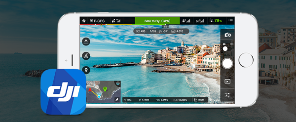
DJI plans to introduce a dynamic geofencing system that continuously provides updated airspace information to the operator. Data comes from Geospatial Environment Online (GEO). Drone operators will see temporary flight restrictions (TFRs) in real time, including forest fires, major stadium events, VIP travel, and restrictions around prisons, power plants, and other restricted areas such as national parks.
However, operators with verified DJI accounts could temporarily unlock or self-authorize flights in some of those locations, but not in sensitive national-security locations. This to accommodate the authorized applications and provide accountability if the flight is later under investigation.
DJI intends to start this in December, first in North America and Europe via a DJI Go app update, and also a drone firmware update.
GEO is powered by geospatial data from Santa Monica, California-based AirMap, which calls itself “the leading provider of airspace information and services for drones. AirMap’s real-time services are available to manufacturers through an API and through an SDK for application developers.”
Just as we were recording this episode, a video was posted from Drone World Expo titled DJI Technology Policy Announcement by Brendan Schulman, VP of Policy & Legal Affairs.
3DR Collaborates with AirMap to Integrate Flight Safety Zone Software into the Solo App
3D Robotics will also integrate AirMap’s safety information into its Solo smart drone app. CEO and co-founder Chris Anderson says, “…we want to make flying as safe as it is easy. Supplementing the Solo app with AirMap’s robust and reliable real-time airspace information allows us to increase education with a seamless and enjoyable drone experience.”
From the 3DR press release: “If Solo users open their Solo app in a restricted area, they’ll see a warning. Users can then tap the warning to bring up a map that displays any airspace information in the area. This airspace information includes real-time Temporary Flight Restrictions that may be established in the areas around wildfires, major sporting events and other sensitive places. The Solo app will contain basic airspace information: federal guidelines (e.g., five miles from an airport); national parks; airbases, etc.”
The World’s Biggest Commercial Drone Maker is Opening a Flagship Store
In December, DJI plans to open an 8,600 square foot flagship store in Shenzhen, China. A DJI spokesman said, “We want more people to see and touch our products.”
Start-up ArcadiaSky creates marketplace for commercial UAV hire
Australian company ArcadiaSky wants to make it easier to find licenced commercial UAV operators. After two months, they have 180 drone operators in 74 locations in Australia, the United Kingdom, and the United States. They’ve received over 1,300 requests for quotes.
ArcadiaSky describes a free, three-step process:
- Define your requirements on a request for quote
- Choose your pilot based on your requirements
- You are put in contact with the drone operator
FAA: Think Twice about “Drone Registration” Firms
The FAA has issued a statement saying UAV owners should wait for the registration process to be announced before they work with any company that offers to help you with registration.
At least one company is offering this kind of service.
The FAA wants “a streamlined unmanned aircraft registration process that will be simple and easy to complete… The Task Force …is working on recommendations for a system that is similar to registering any newly purchased product with its manufacturer…”
Chicago City Council Approves Ban On Drones
The Chicago City Council approved an ordinance regulating drone use and requiring that drones cannot fly above 400 feet, must be line-of-sight, and cannot fly within five miles of O’Hare and Midway Airports. Also, no flying of drones over schools, churches, hospitals, police stations, and any private property without consent.
Video of the Week
DroneFest, the International Drone Film Festival
This international film and photography competition culminates in a one-night festival dedicated to everything drones. It’s part of the SkyTech 2016 Drone Expo on the 27th January 2016. Submissions are accepted until December 13, 2015.

Chicago resident checking in with a minor correction on status of Meigs Field. Only the terminal and tower remain. The runway and taxiways have all been removed and replaced with hills and a lagoon. Google Maps now has updated imagery of the area. It actually looks like a pretty cool place to fly a UAV.
https://www.google.com/maps/@41.8560231,-87.6087904,1150m/data=!3m1!1e3
Great episode guys! As a commercial UAV operator in Canada with Control Zone Airspace Flight Authority, DJI will unlock restricted areas for commercial operators who can provide proof of their Federal Authority.